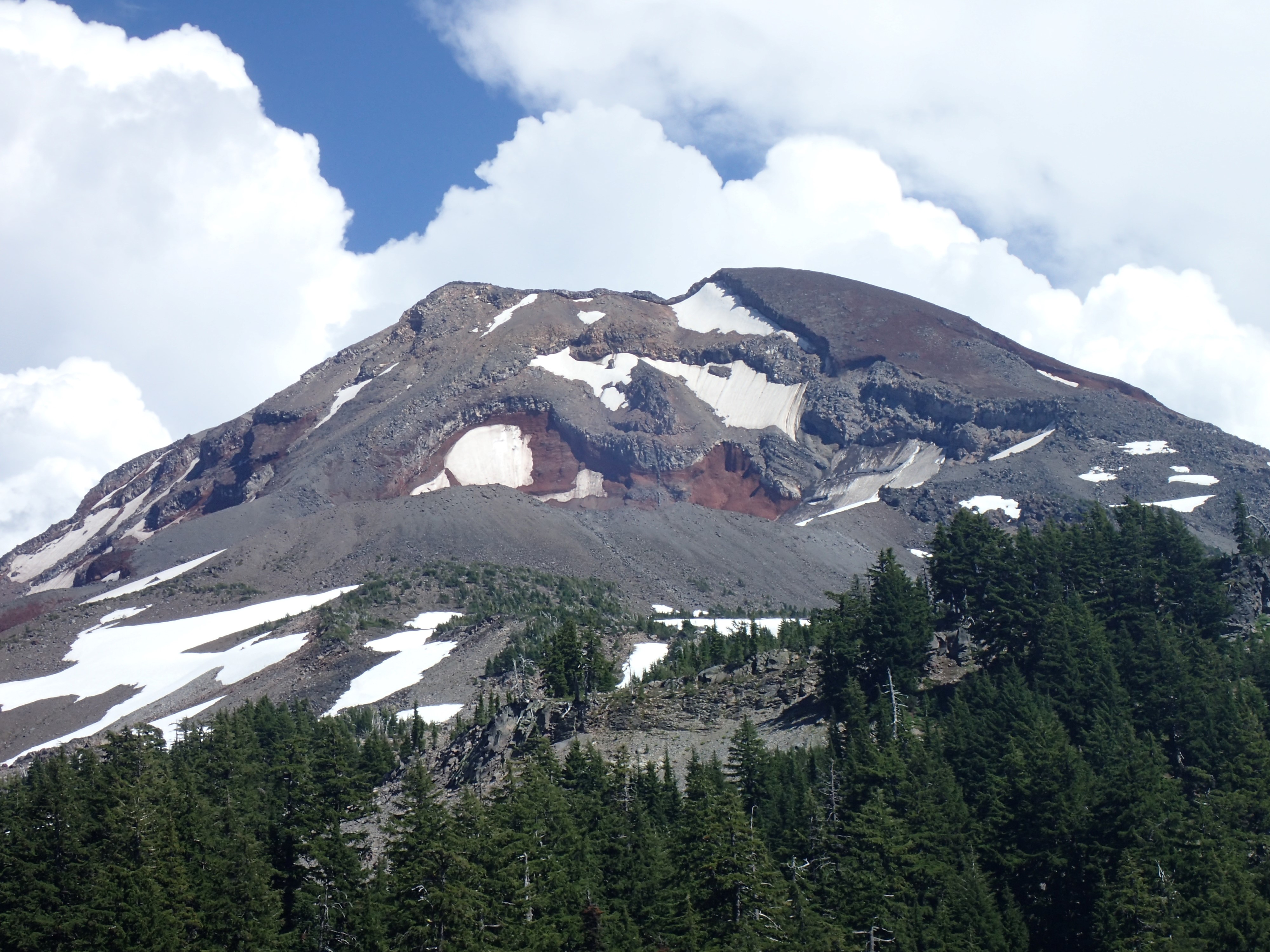
When we reached Reese Lake after 3pm we finally got a full view of the South Sister. It is an imposing mountain:
In this close-up to can see the interesting patterns of erosion:
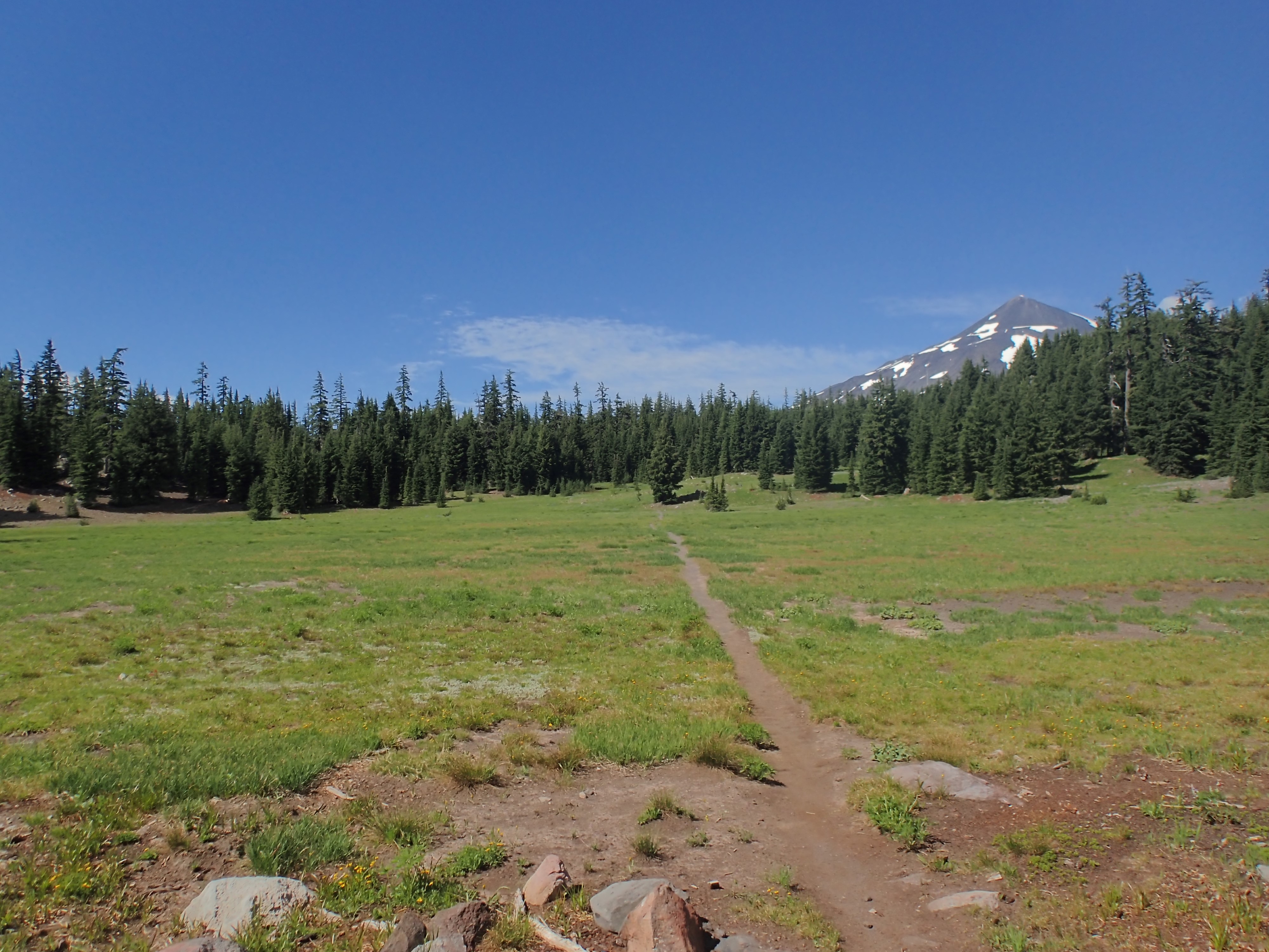
This photo is looking back across the flats just north of Hinton Creek. That’s the Middle Sister on the right:
As it neared 5pm we started seeing dark clouds on the horizon. We passed a thru hiker headed north who warned us that Wickiup Plain was a little over a mile ahead. Wickiup plain is open and rocky. The thru hiker said it was like an oven out there and he wished us luck. This wasn’t terribly encouraging, as the dark clouds to the east didn’t look like they were going to shade us.
The low, grey hill on the horizon is Rock Mesa, a huge glob of lava on South Sister’s flank. Wickiup Plain starts at it’s base:
This is the picturesque Mesa Creek. Note that the storm clouds are building, but it is still nice where we are:
This is a tributary of Mesa Creek, but it apparently has no name:

It was a lovely place to take a break though:

And then, just as we got to Wickiup Plain, the temperature dropped, it began to sprinkle, and the lightning and thunder started. Luckily the lightning was far enough away that it wasn’t a threat, and the rain was just a light misting really. The result? We put on our raincoats and had a nice stroll across the plain without having to endure the oven. That’s Rock Mesa on the left, and my camera strap in the upper right corner. The other end of the plain in the distance is about 1.5 miles away:

Here is another shot I took about a mile into Wickiup Plain. The big mountain is the South Sister, and you can see the top of Middle Sister peeking over her shoulder near the center of the picture. Below the South Sister in the foreground is Rock Mesa, and the small hill to the right is a cinder cone named Le Conte Crater:

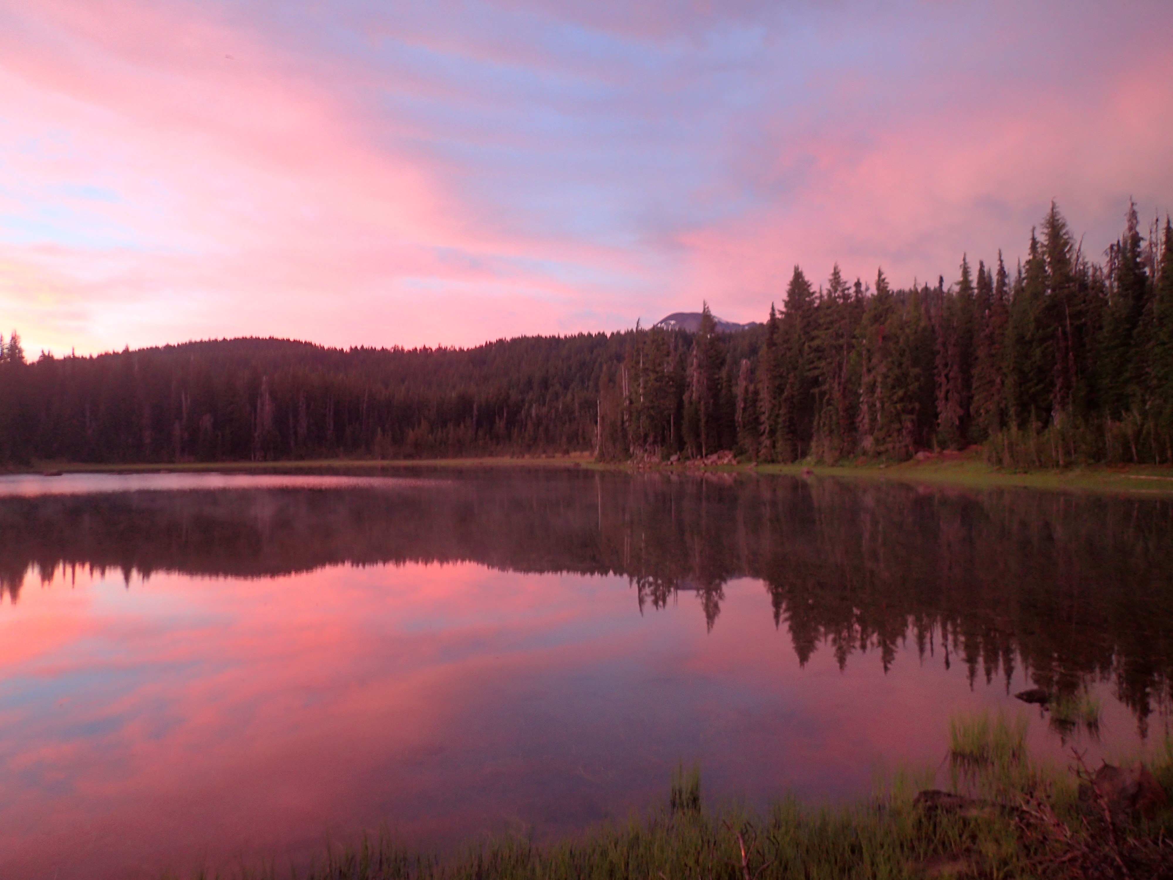
Finally, after a bit over 10 hours of hiking, we reached our destination for the day: Sisters Mirror Lake. The storm was dissipating and we were treated to a spectacular sunset:
What a day! 14.5 miles of hiking through fantastic scenery and interesting weather. We hung our hammocks in the trees, ate dinner, and promptly passed out.
Here is my KMZ file with our route for the day, all the picture locations, plus waypoints and local landmarks. Please feel free to download the file and view it in Google Earth.
What a wonderful trip! We are all enjoying living vicariously through you and Jody’s adventure. :) Love you!
Hi, thanks for the posts. My husband and I are about to embark on a 4 day trip into the 3 Sisters via Obsidian area and were interested in what you had to say and your photos. Regarding the flower: it’s Snow Buttercup, Ranunculus eschscholtzii
Tina
Thank you. I have edited the text and credited you. I hope your trip is (was) great.