On Mother’s Day I hiked the Harris Ranch Trail. I made sure to call my mother the night before, and going on Mother’s Day was my wife’s idea, so it was a ‘safe’ plan.
My brother was unable to join me on this hike, so I went alone. Not that I was truly alone – I saw seven people and a dog over the course of the afternoon.
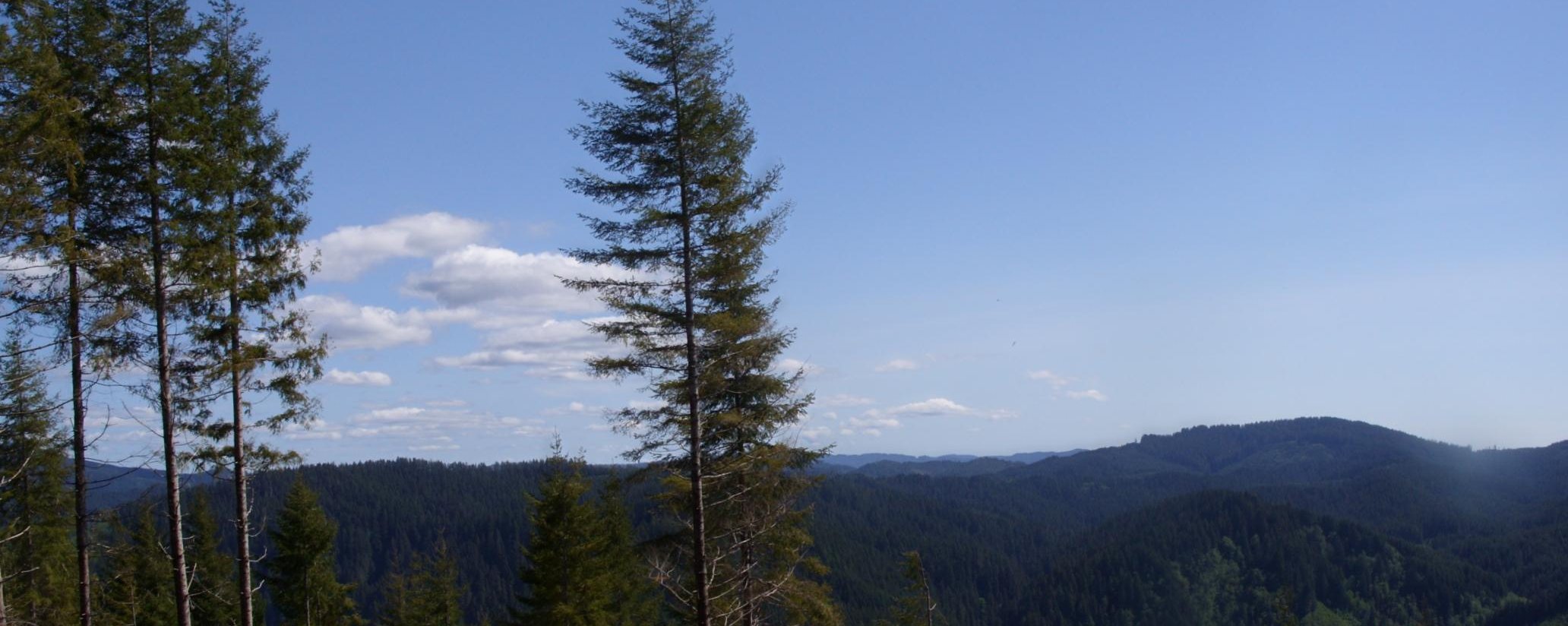
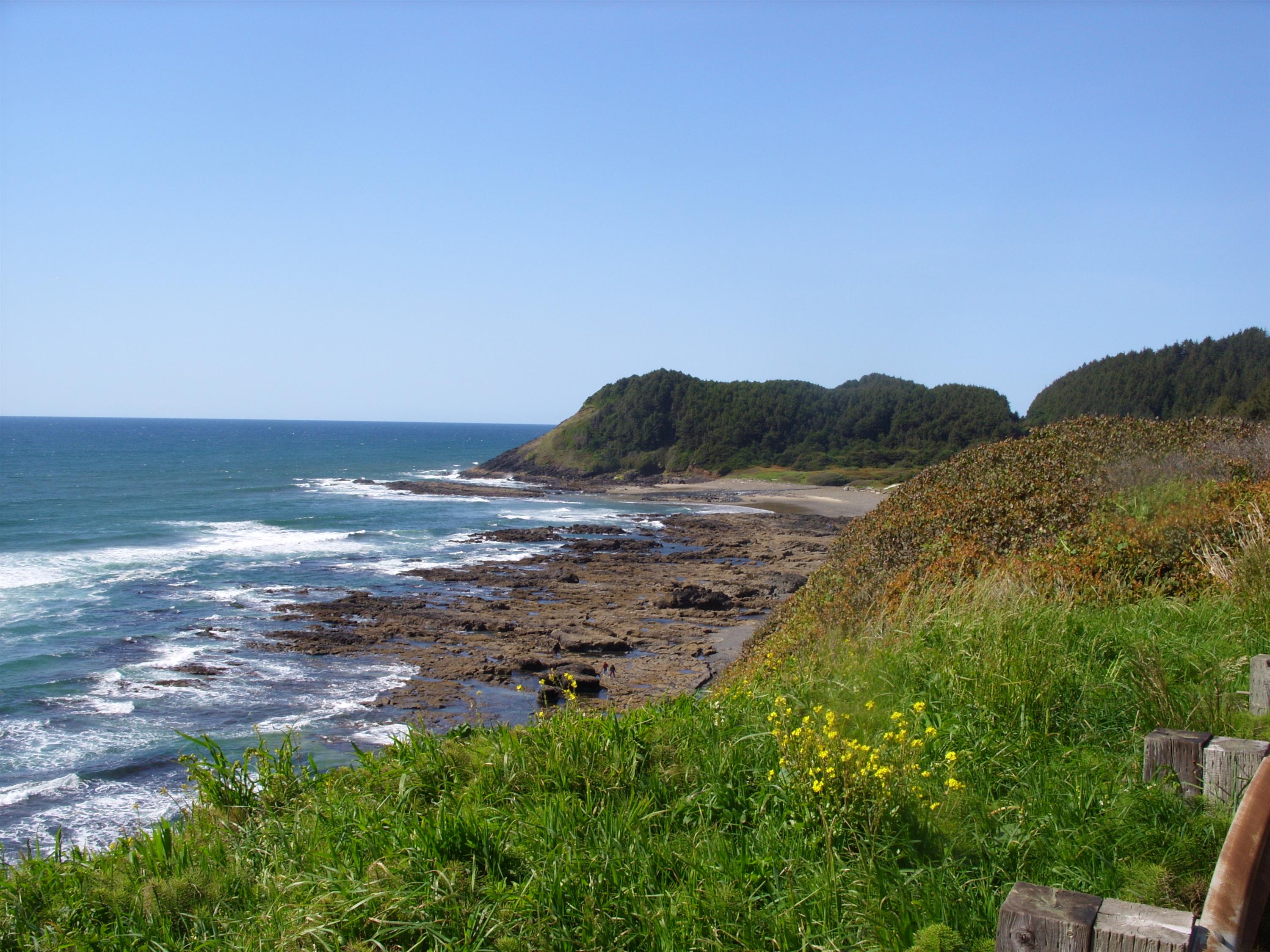
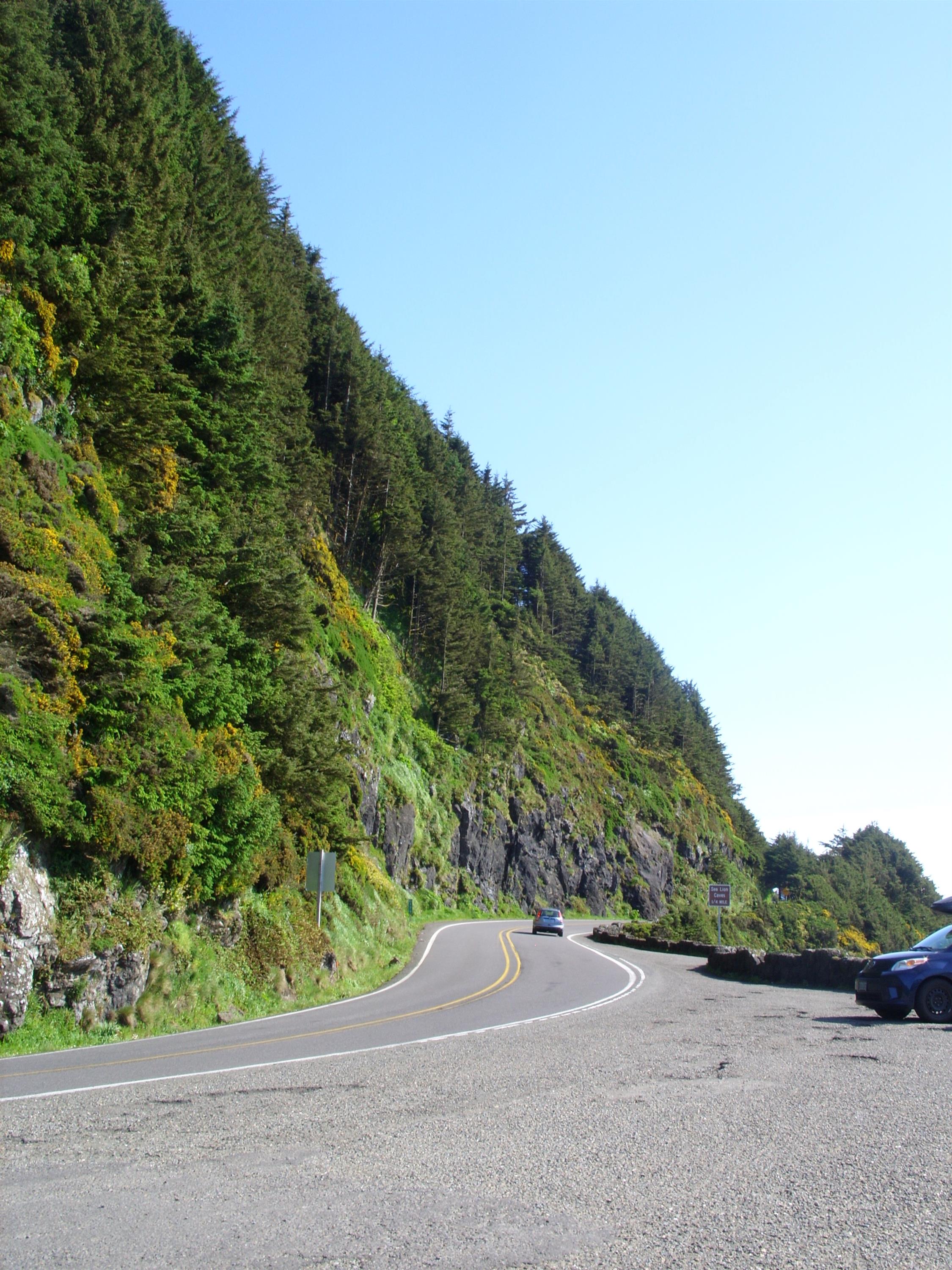
This trail is fairly short at 3 miles, but I wanted to scout it out because I will be going on a group outing to this location in late August. Located in the Drift Creek Wilderness on the Oregon coast, it is a bit out of my normal hiking area. It took a little over two hours to reach the trailhead, but it was a fabulous drive. The hike starts at the top of the ridge, and essentially follows it down to the creek at the bottom. Of course, this creek is 40 feet wide, too deep to see the bottom, and this time of year too fast to think of swimming, so it’s really more of a river. It was also a pretty good day for the Oregon coast in May with clear skies, a light breeze, and about 70°F. Here’s a view from the top of the ridge, just a little way down the road from the trailhead, just to set the tone:
The top section of the trail follows an old road, and descends gradually for about 0.6 miles:

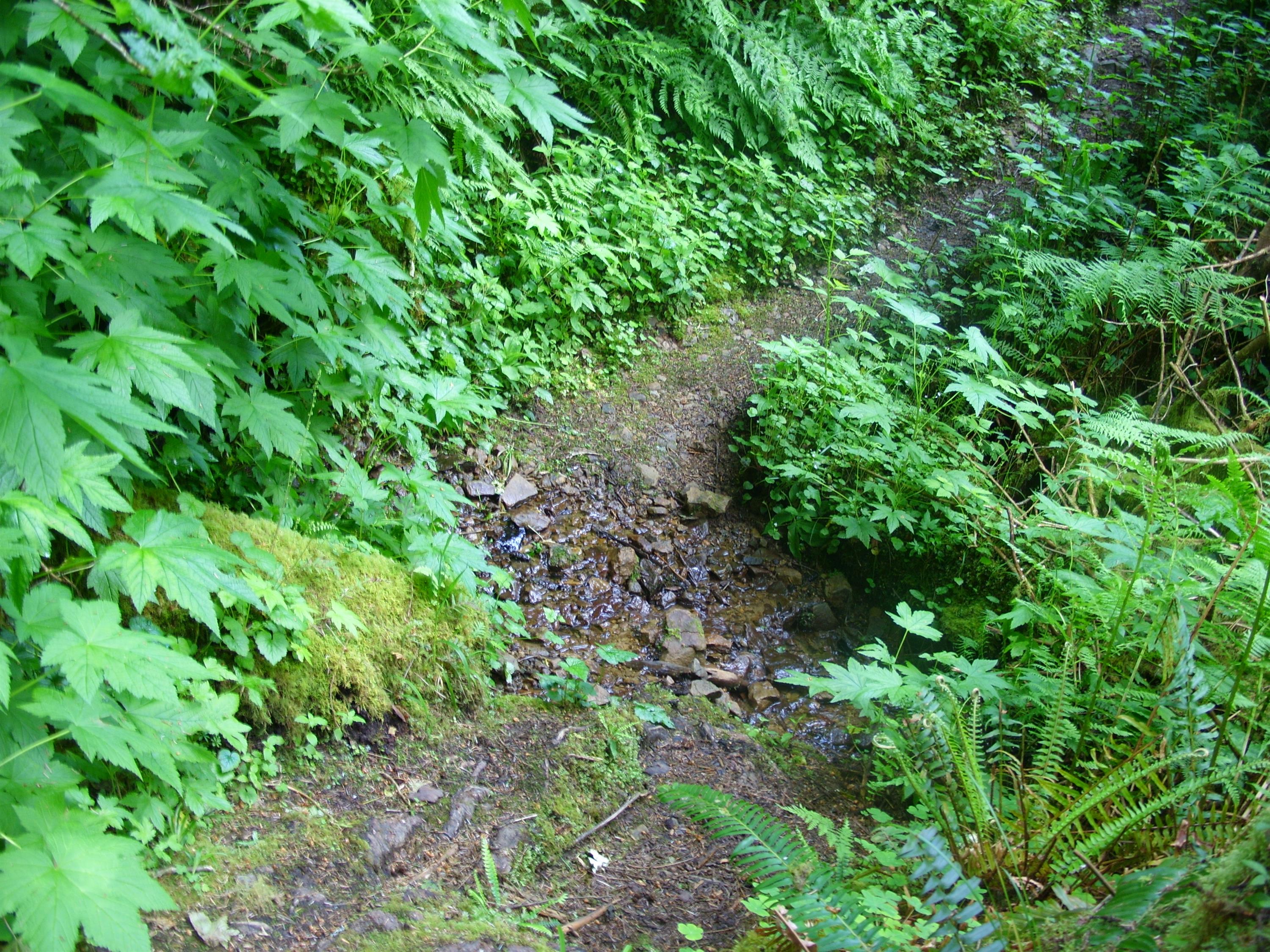
It is spring in Oregon, so even though it was a nice day and the foliage was dry, there were lots of little creeks flowing across the trail:
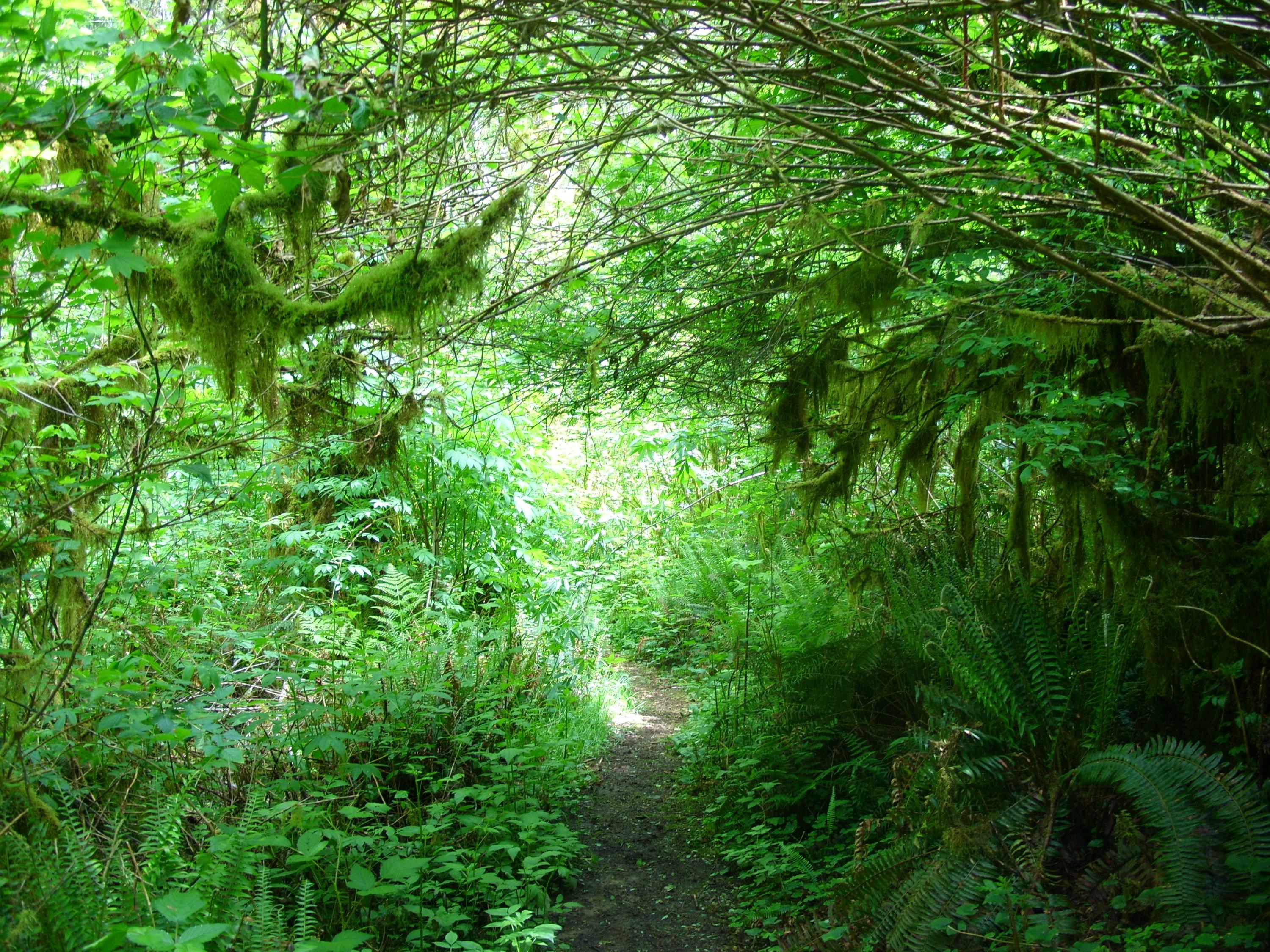
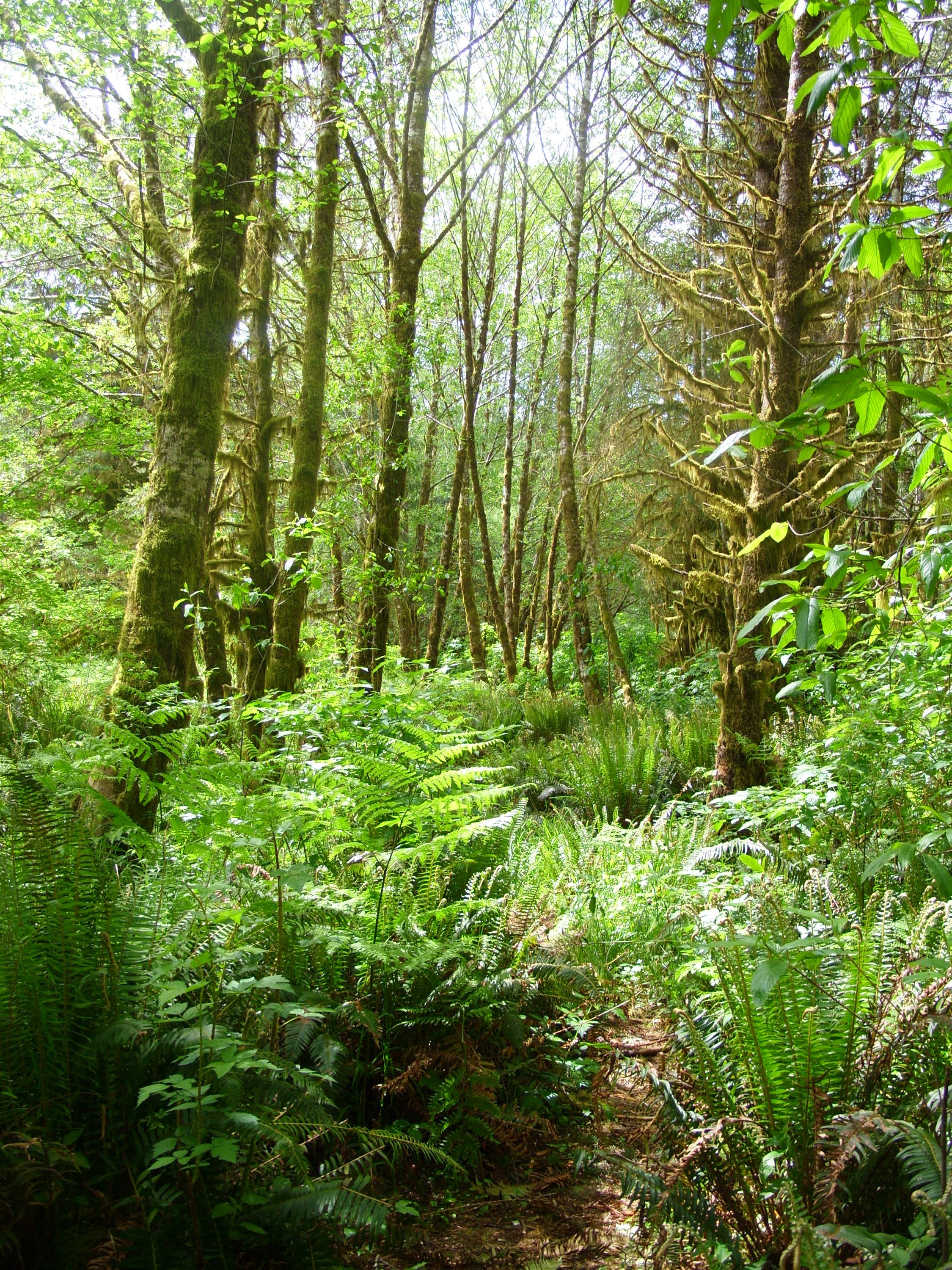
Everything was green and alive. Moss was everywhere:
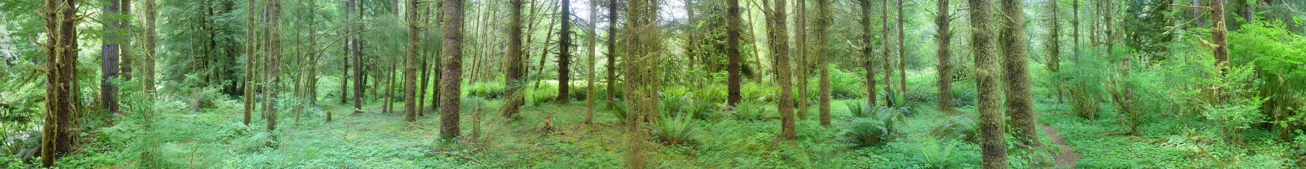
Here is a 200° panorama I stitched together:
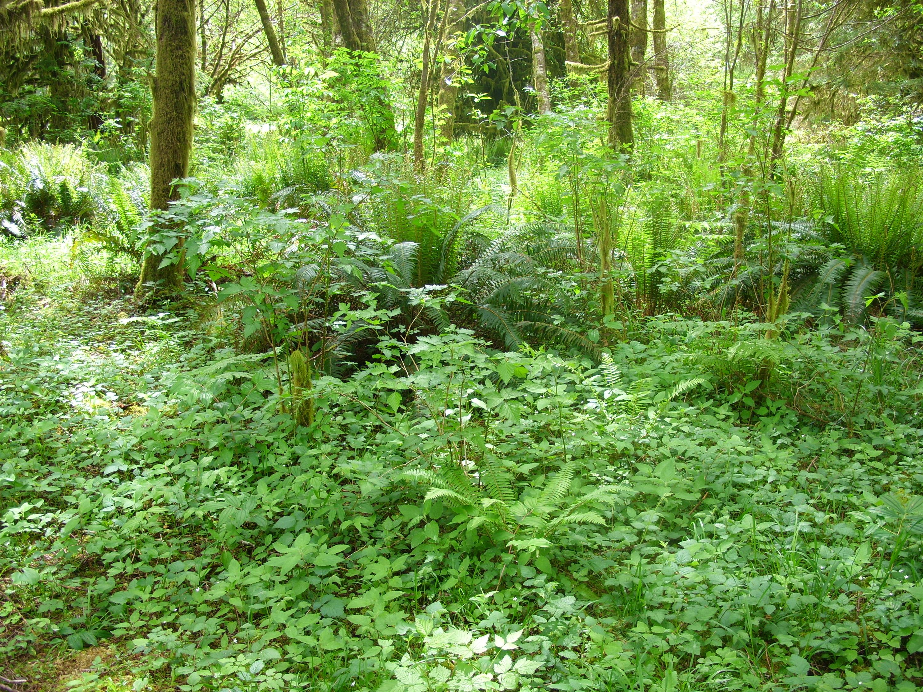
Everywhere I looked I saw ferns, salal, and vines growing like crazy:
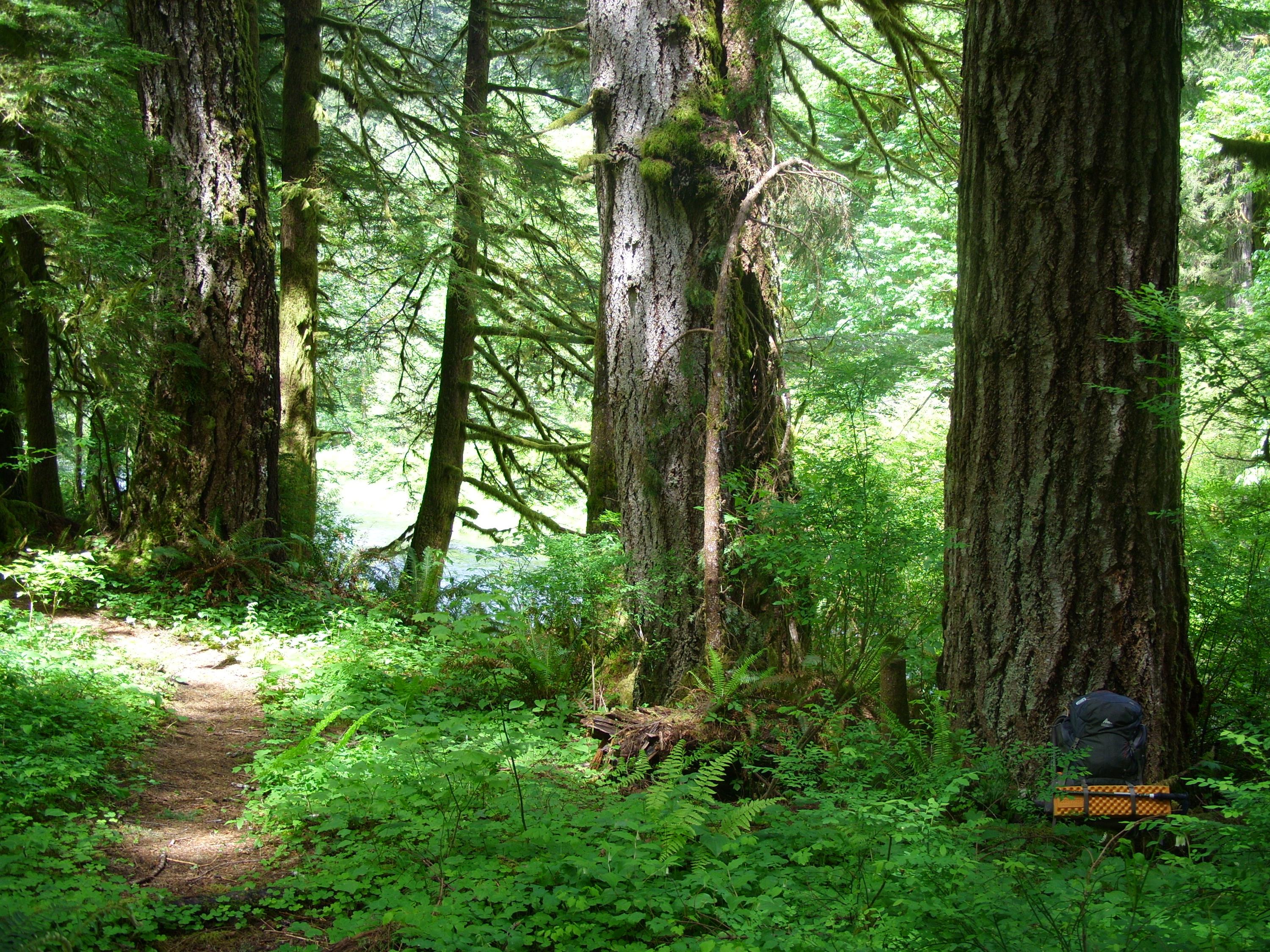
This area is all old-growth, so it hasn’t been logged in a long time, if ever. Trees more than 4 feet in diameter are a dime-a-dozen out here, and it didn’t take much looking to spot even bigger specimens. In this picture you can see my full-size 75 liter backpack leaning against a monster tree in the lower right. Note that my pack is about 20 inches wide (the brown part, not the orange pad):
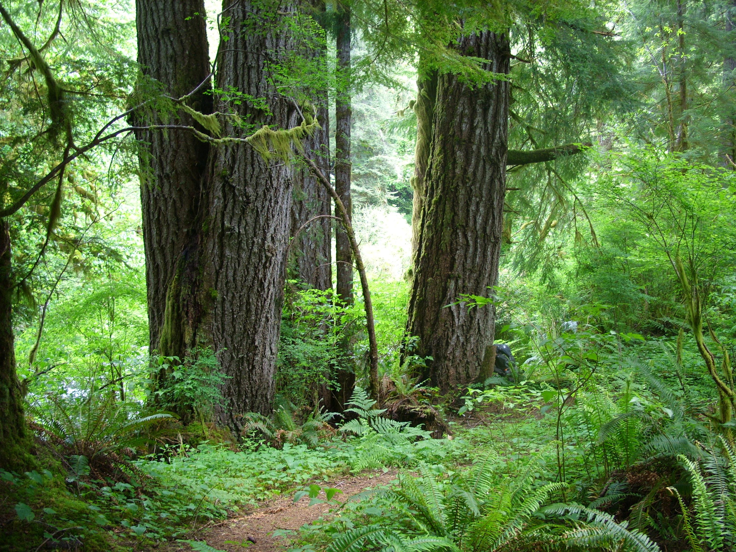
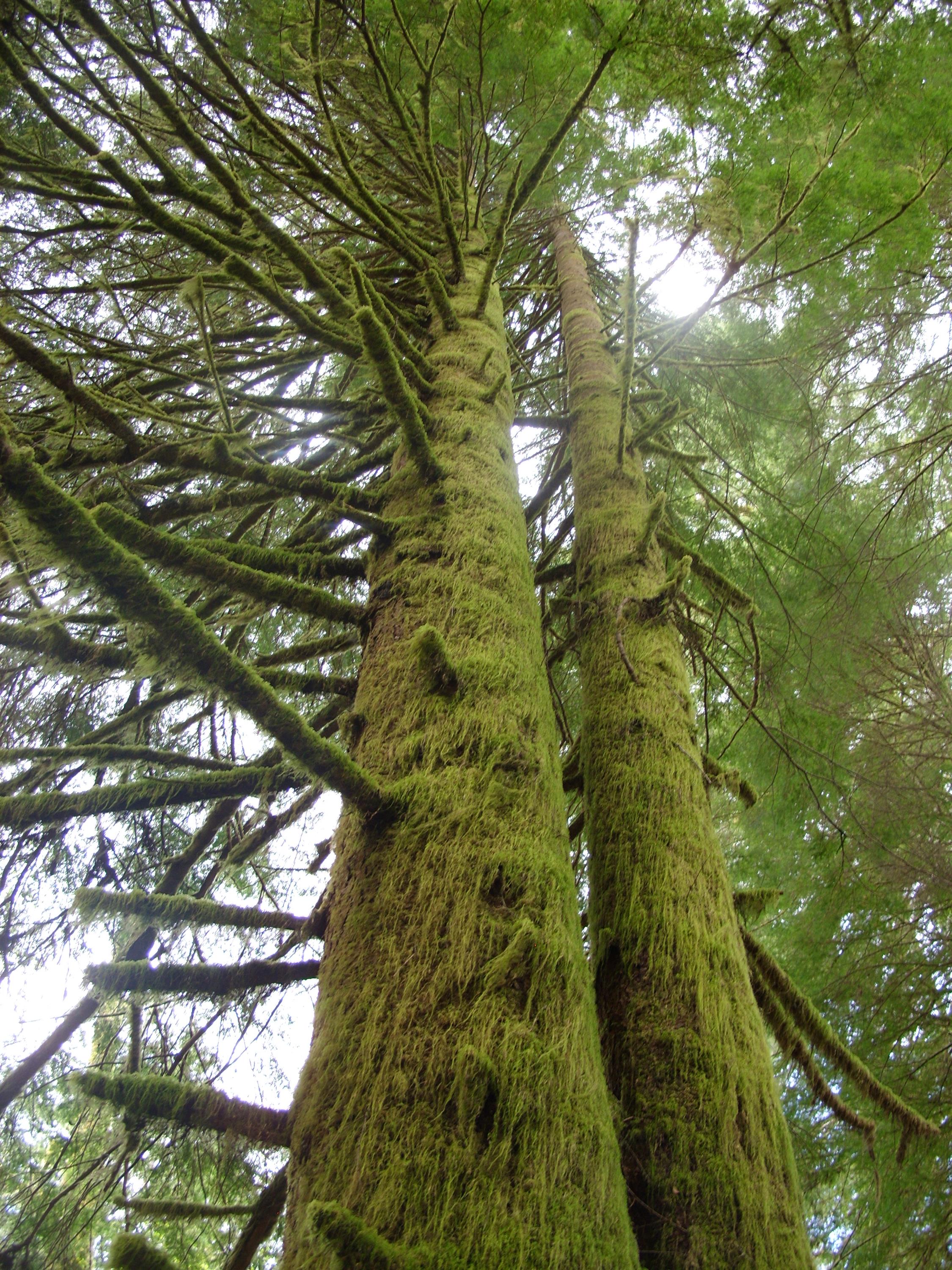
Here is the same group of trees from another angle. They are all huge:
This tree isn’t too big, but it is just covered in moss:
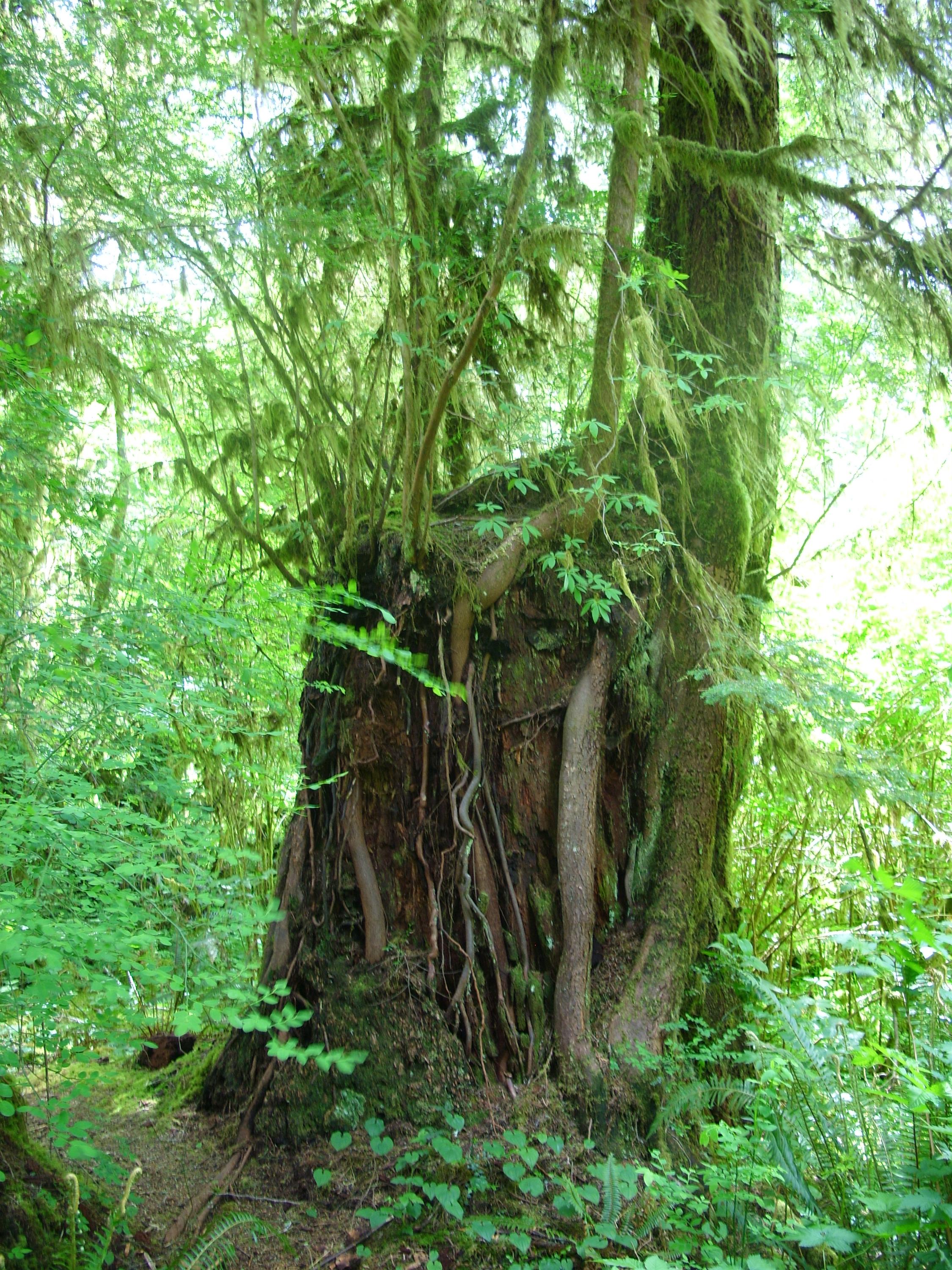
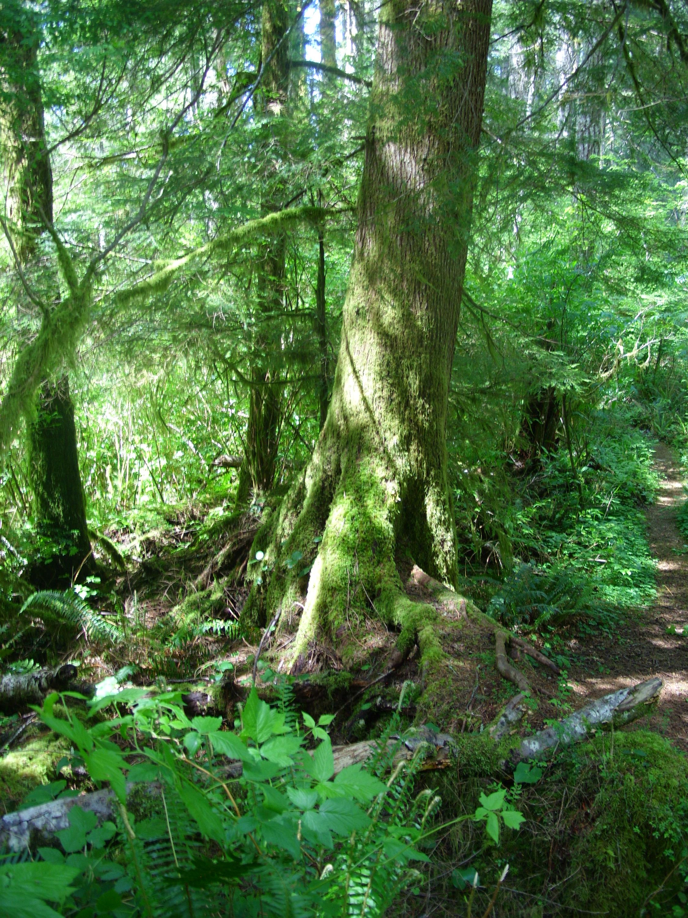
Here a pretty sizable tree has taken root and grown on top of (and down around) a great big stump:
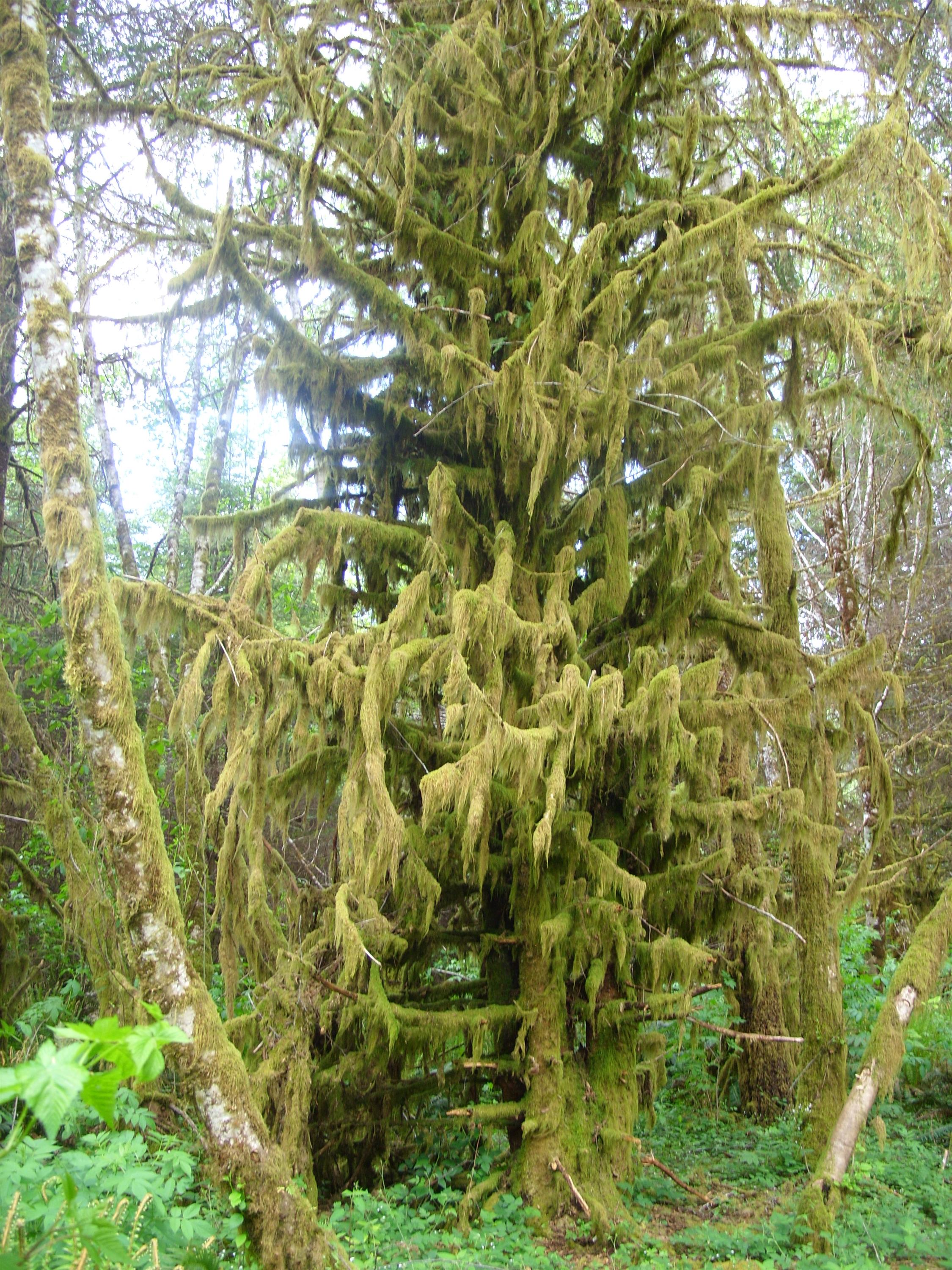
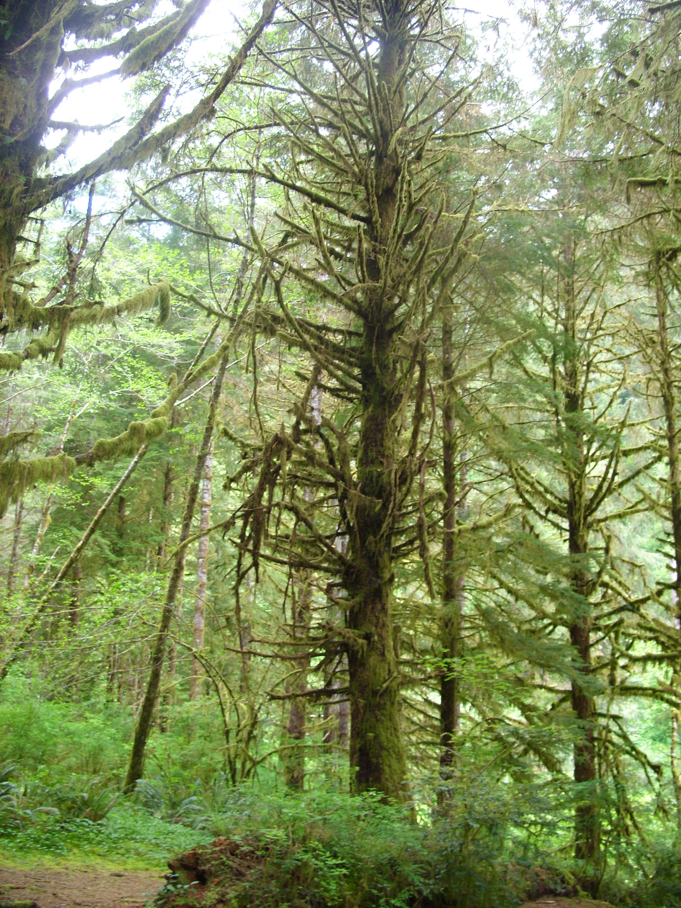
A good percentage of the trees wear a moss coat:
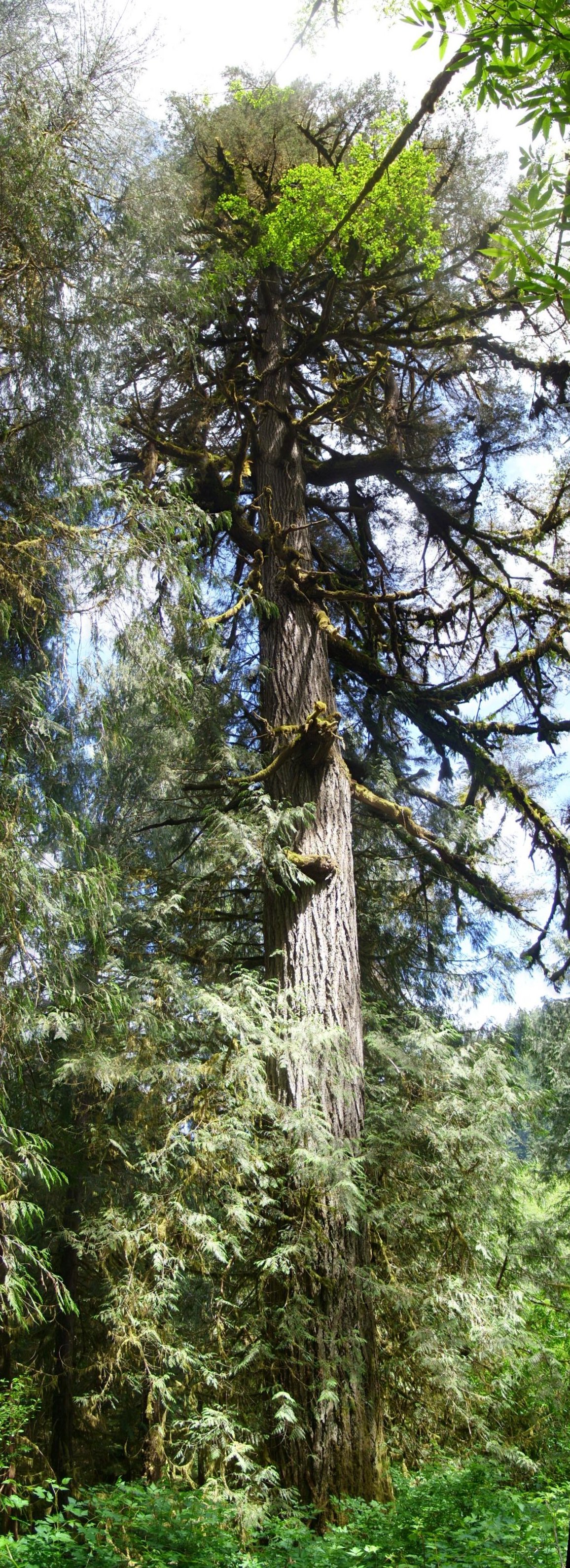
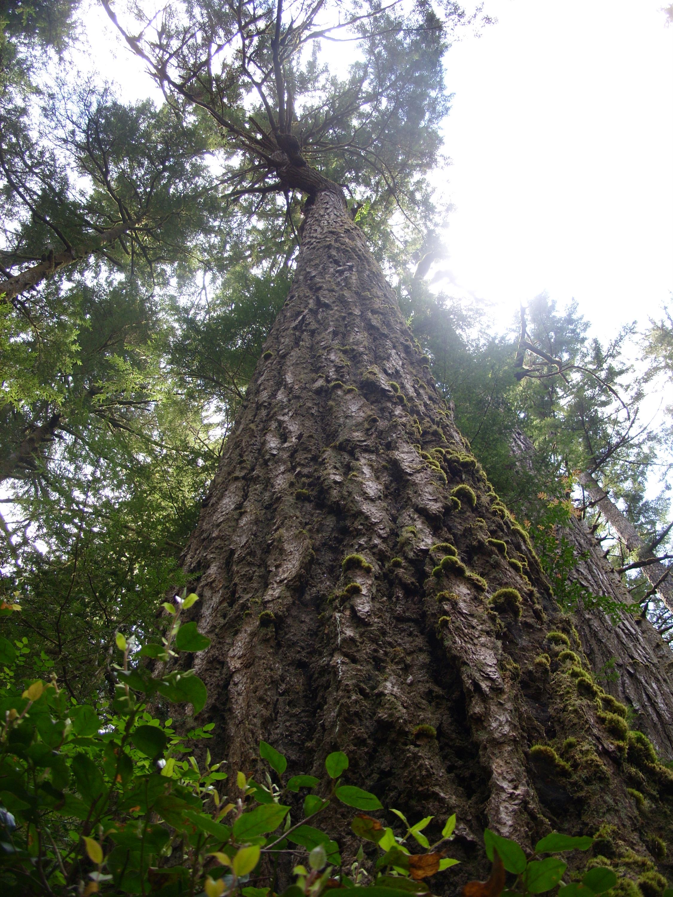
This massive Douglas Fir is about 7 feet across at the base:
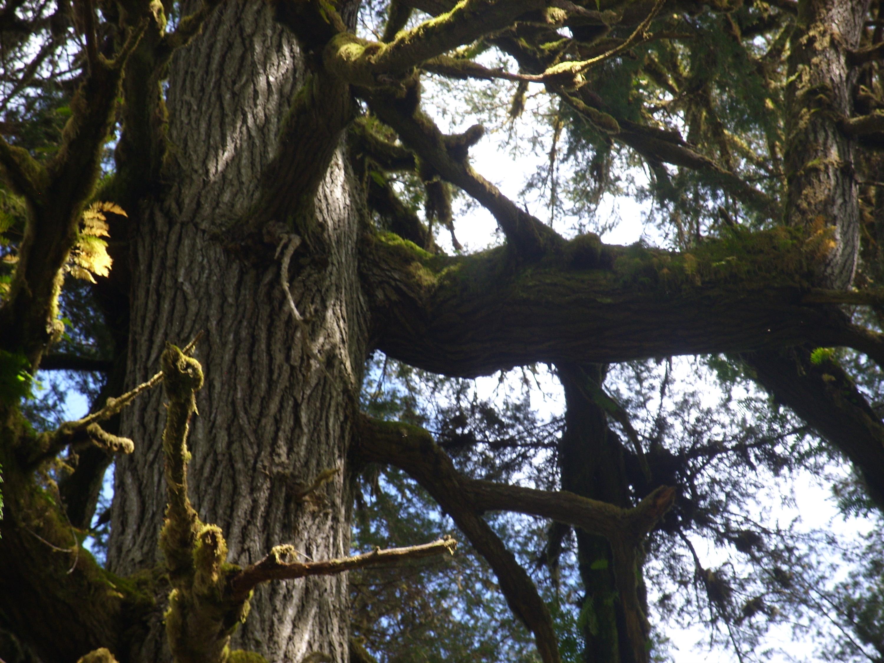
This is a closeup of a branch about 75 feet up the tree. The branch is as big as a tree itself with a diameter of about 3 feet. You can see it goes a little way out and then heads straight up. It was like seeing a full size tree growing out of the side of another tree. So cool:
This was the biggest one I saw. It is at least 9 feet across at the base and right next to the trail. What a behemoth:
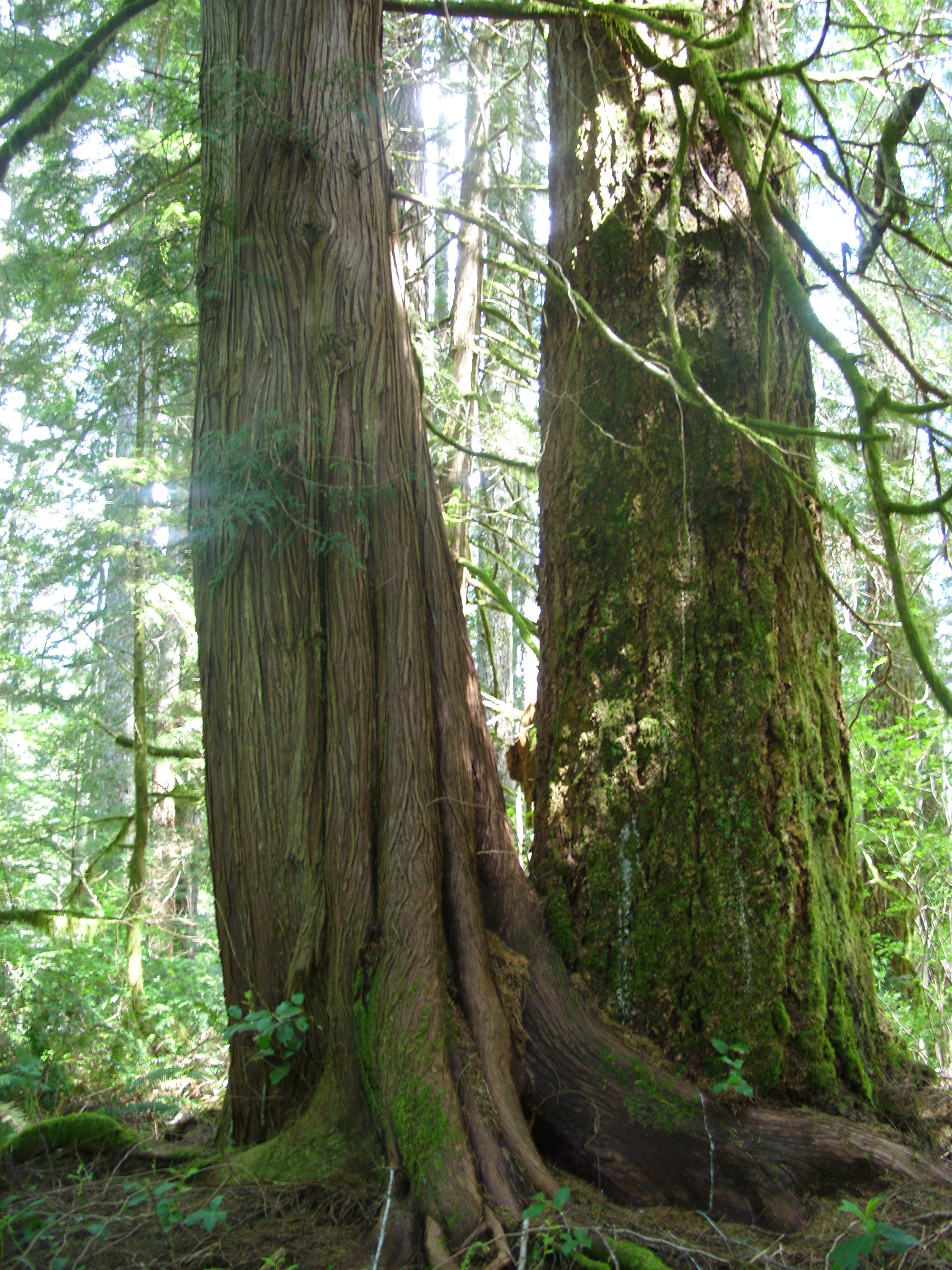
Not all the trees are Doug Fir of course. Though they are usually not as large, there are quite a few large cedars as well. Here is a 5 foot cedar that has grown partway around a 6 foot Doug Fir:
This tree isn’t particularly huge, but it a good example of a nurse log. At some time in the past, a large tree fell. As it rotted in place it became an extra fertile place for new seedlings to take root. Sometimes you will see 10-15 trees in a row, all growing out of the same nurse log. Eventually the log rots away completely, and all that is left is a row of smaller trees that appear to be in an unnaturally straight line. In this case there weren’t many “child trees”. The nurse log starts at the lower right corner of the picture and heads out toward the mid left. The two trees immediately to the left of the big one in the center are “children”:
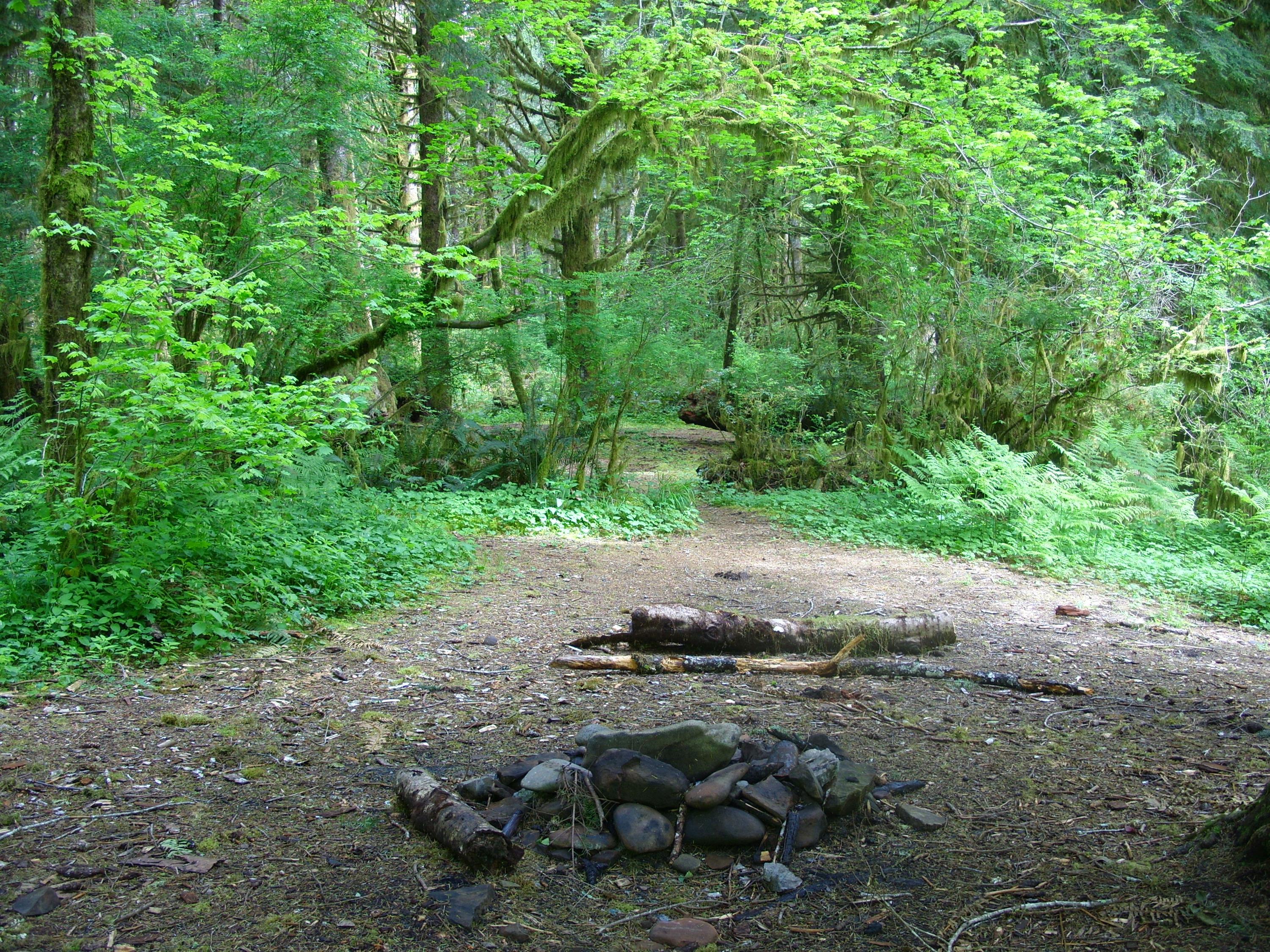
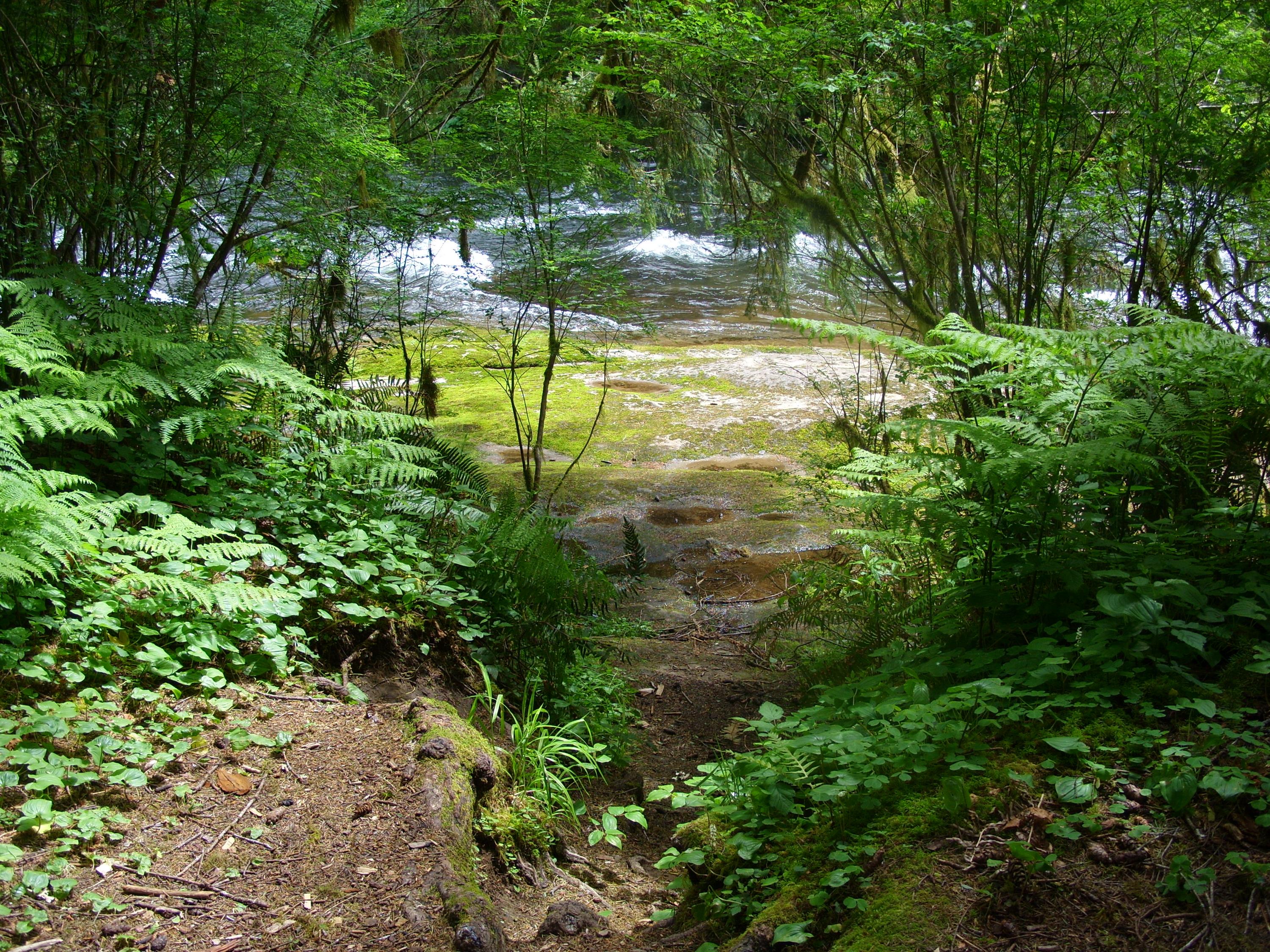
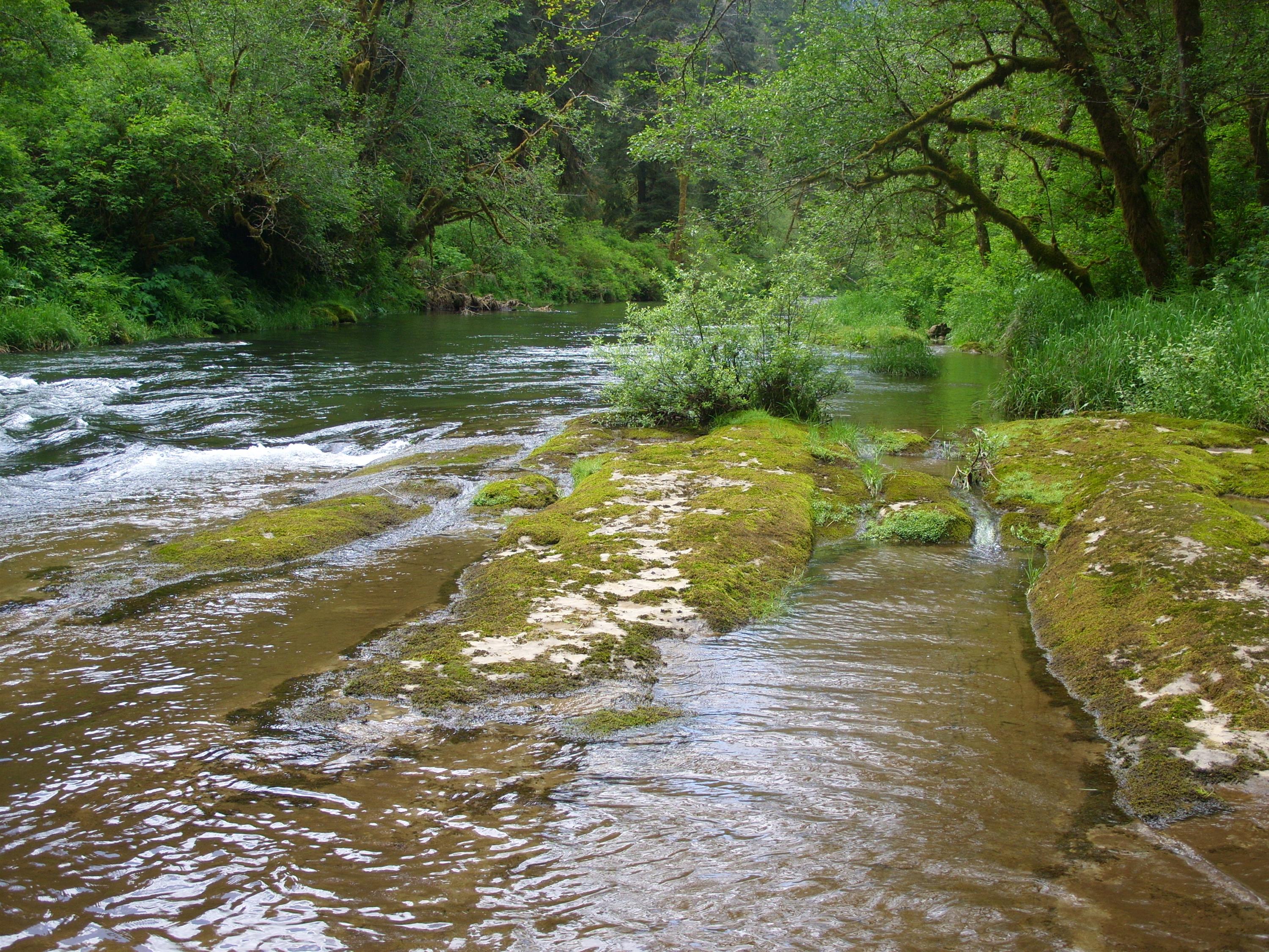
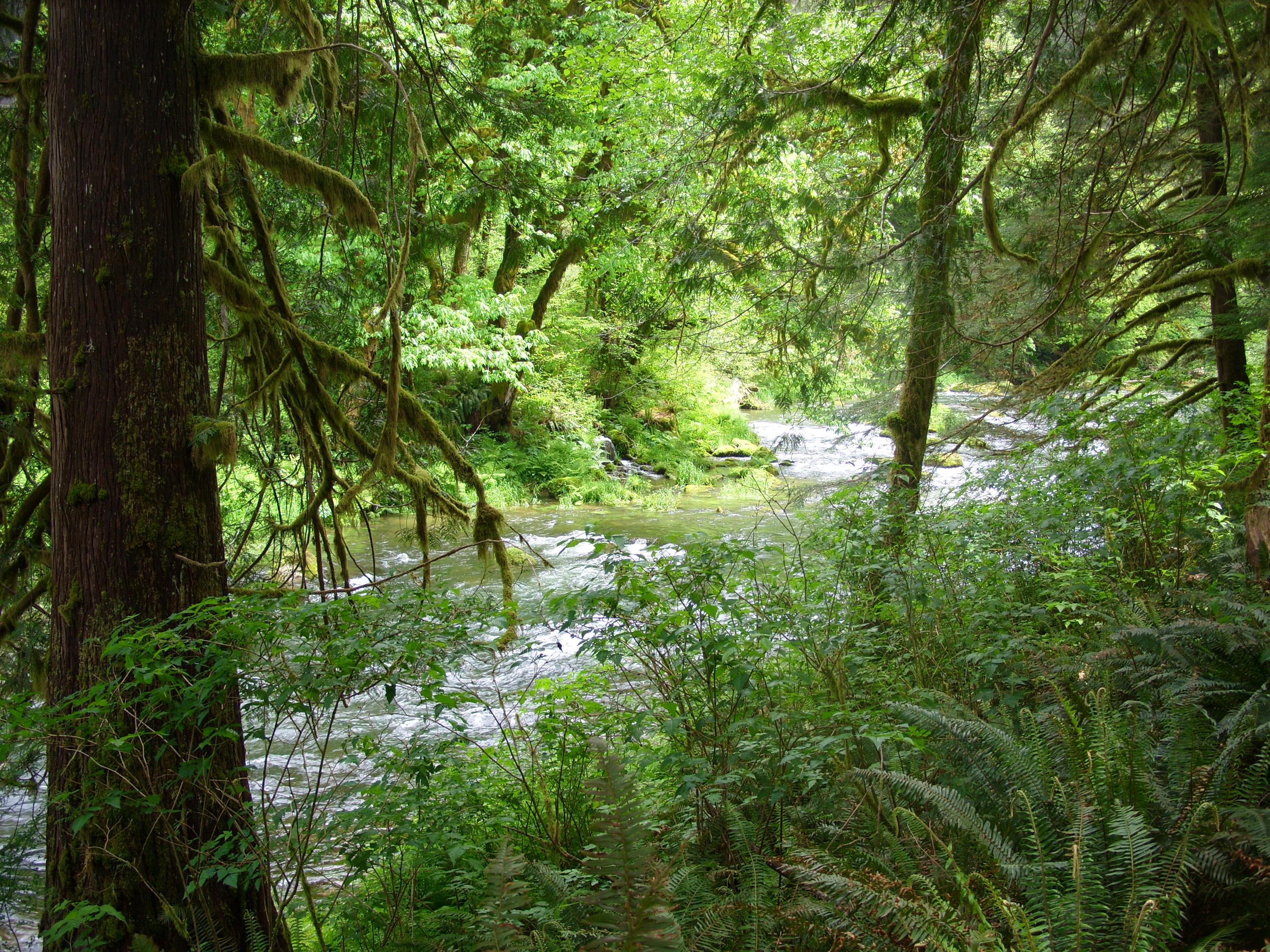
After about 3 miles, I reached Drift Creek. The trail extends in either direction along the creek, but not for long. I have read that later in the season when the creek is running low, you can wade across and continue along another trail for a few miles. In any case, there is an obvious campsite right where the trail reaches the creek, shown here. You can see the trail that goes to the right along the creek directly across from the firepit. There were two more fire pits over a few hundred yards of trail directly behind me:
At that same location there is a gap that leads down to the creek, with a nice rock shelf and some shallow water:

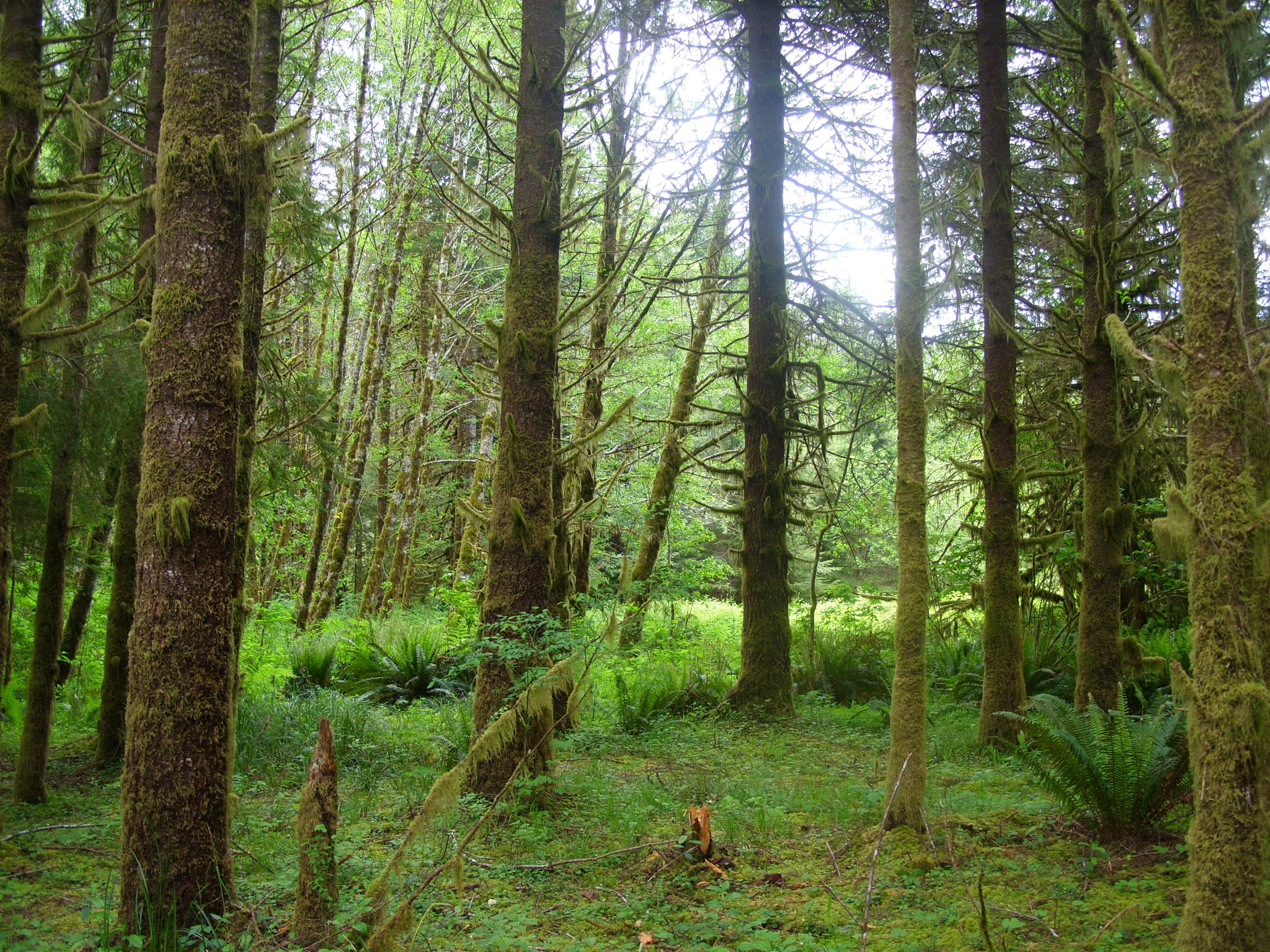
Although there are some large trees down here in the bottoms, most of the trees are smaller and there is a lot more moss:
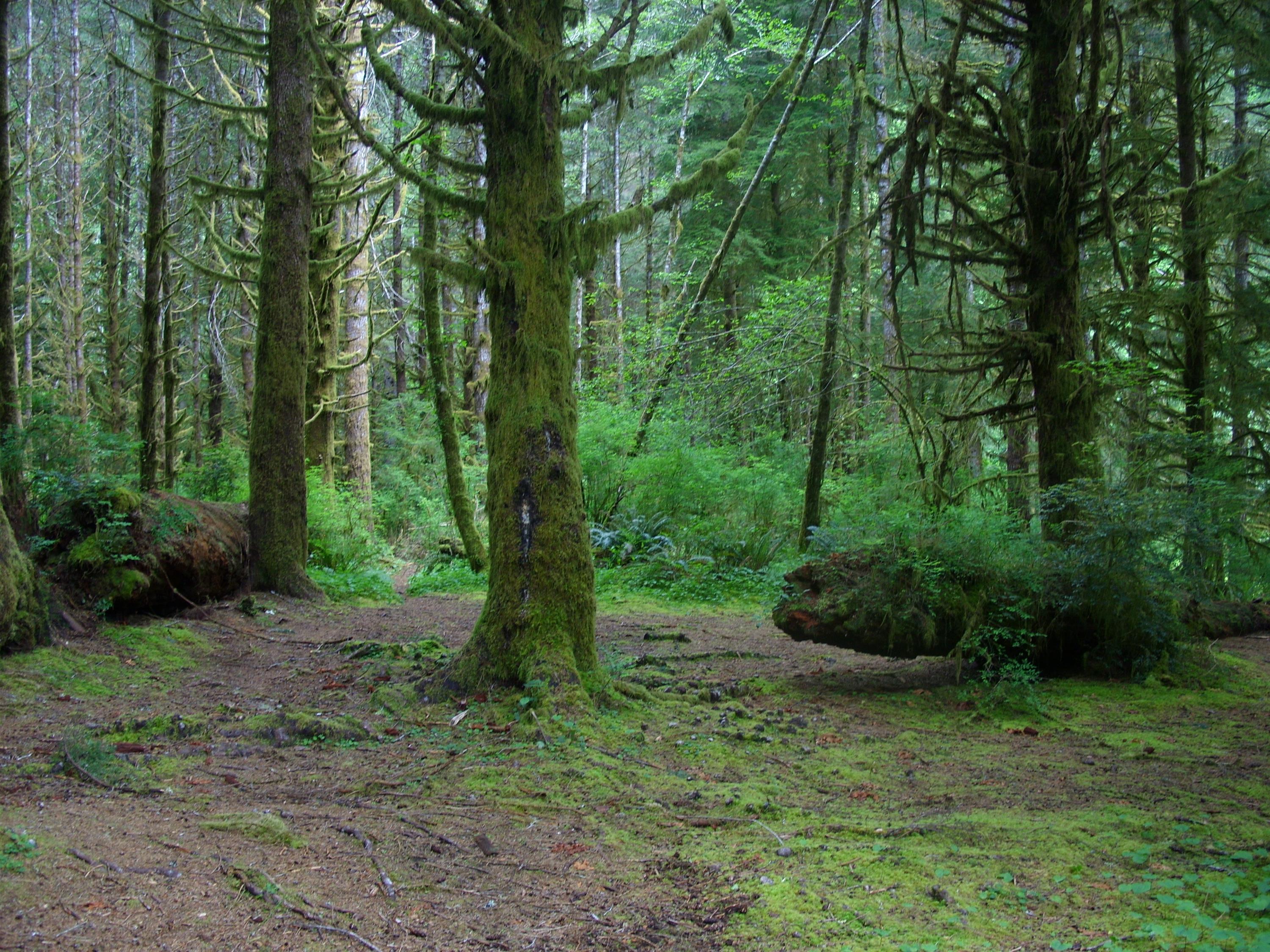
The flat ground and the types of ground cover I saw here suggest to me that this area likely floods out at some point in late winter and early spring:
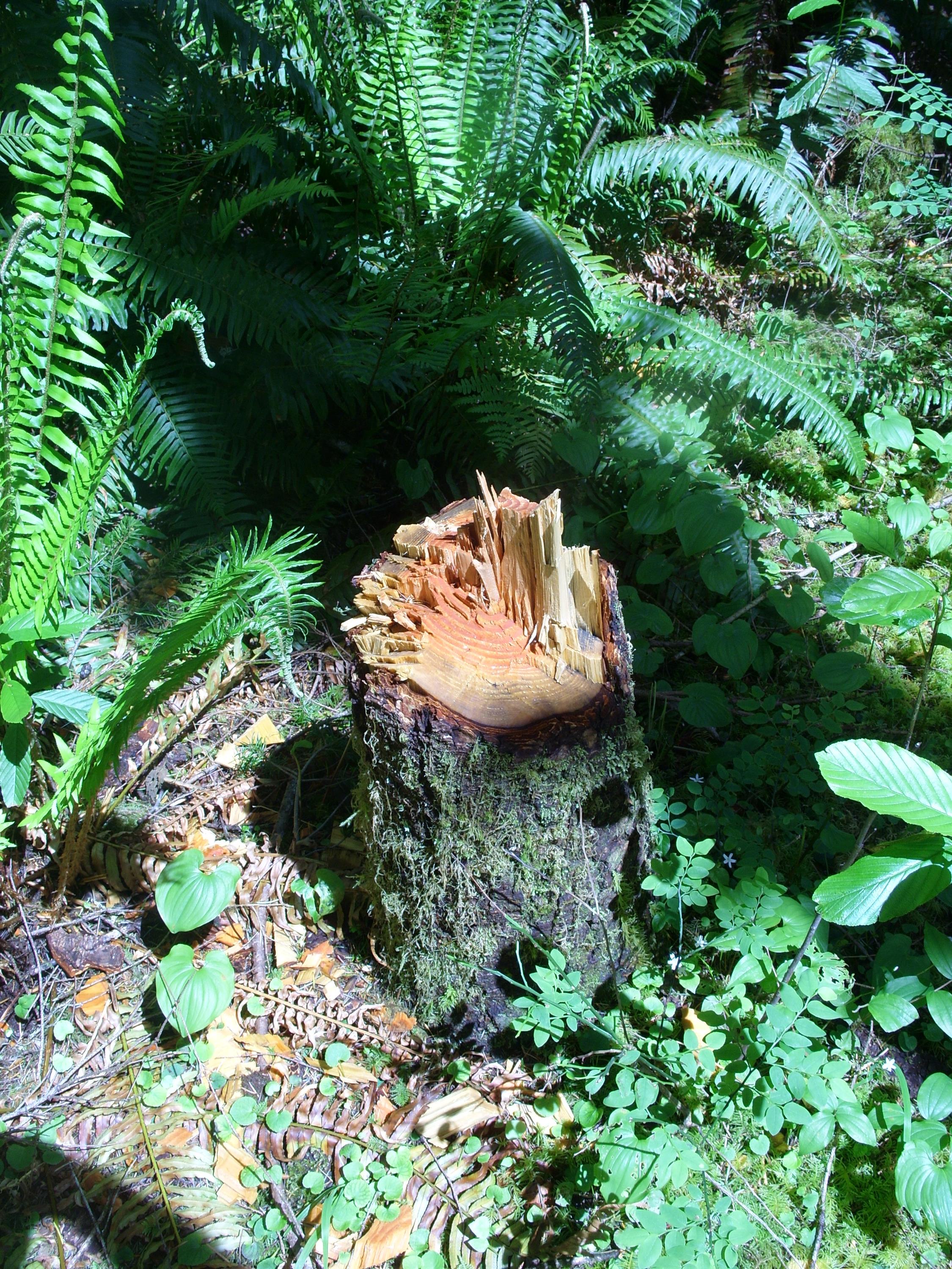
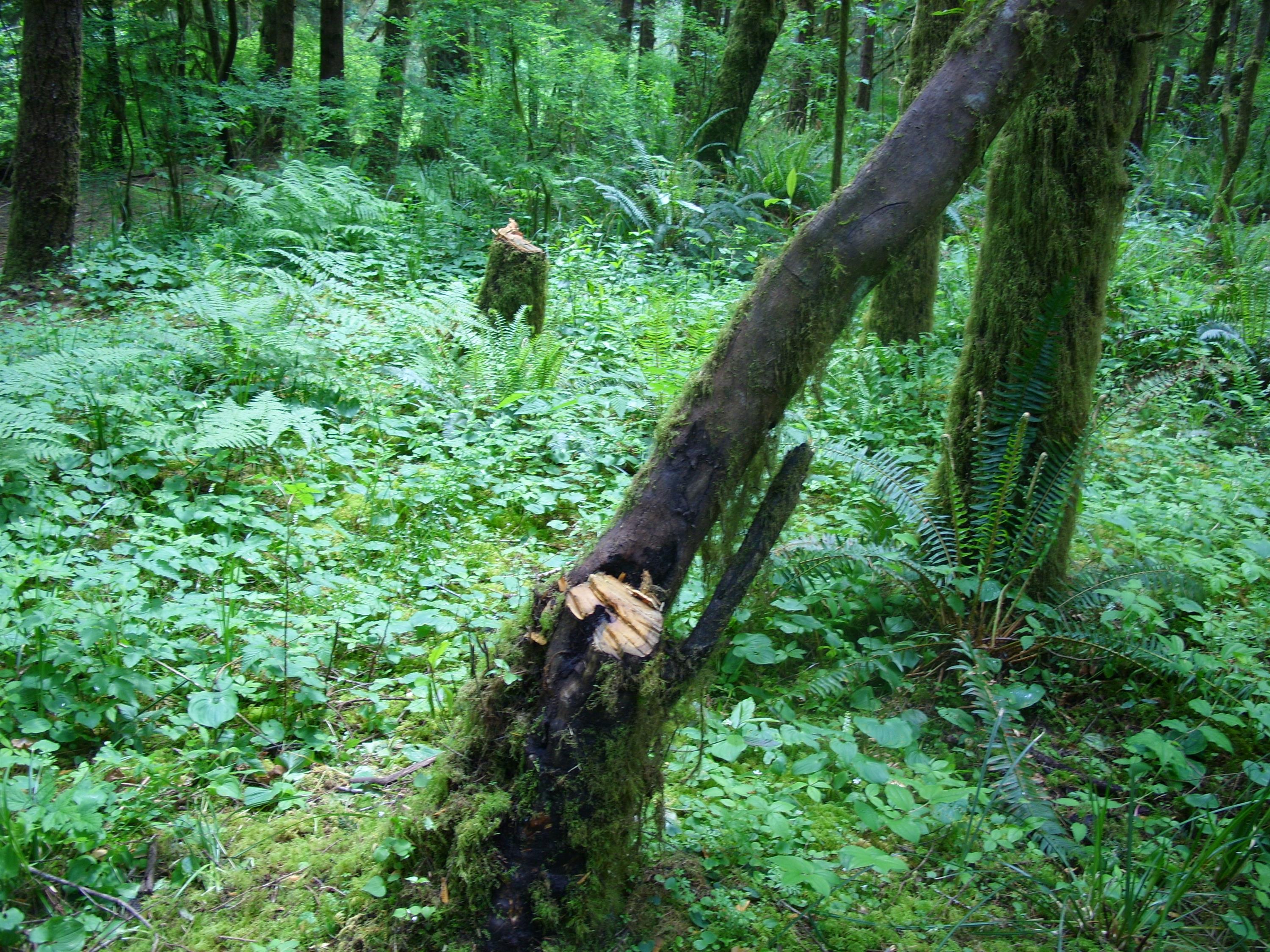
Unfortunately it was not all beauty out here. This area clearly is getting a lot of use. This is a federal wilderness within the Siuslaw National Forest. Cutting live trees is not only discouraged – it’s illegal out here. Unfortunately, this doesn’t stop some people. I saw numerous examples of live trees cut down, most likely for firewood. What a shame:
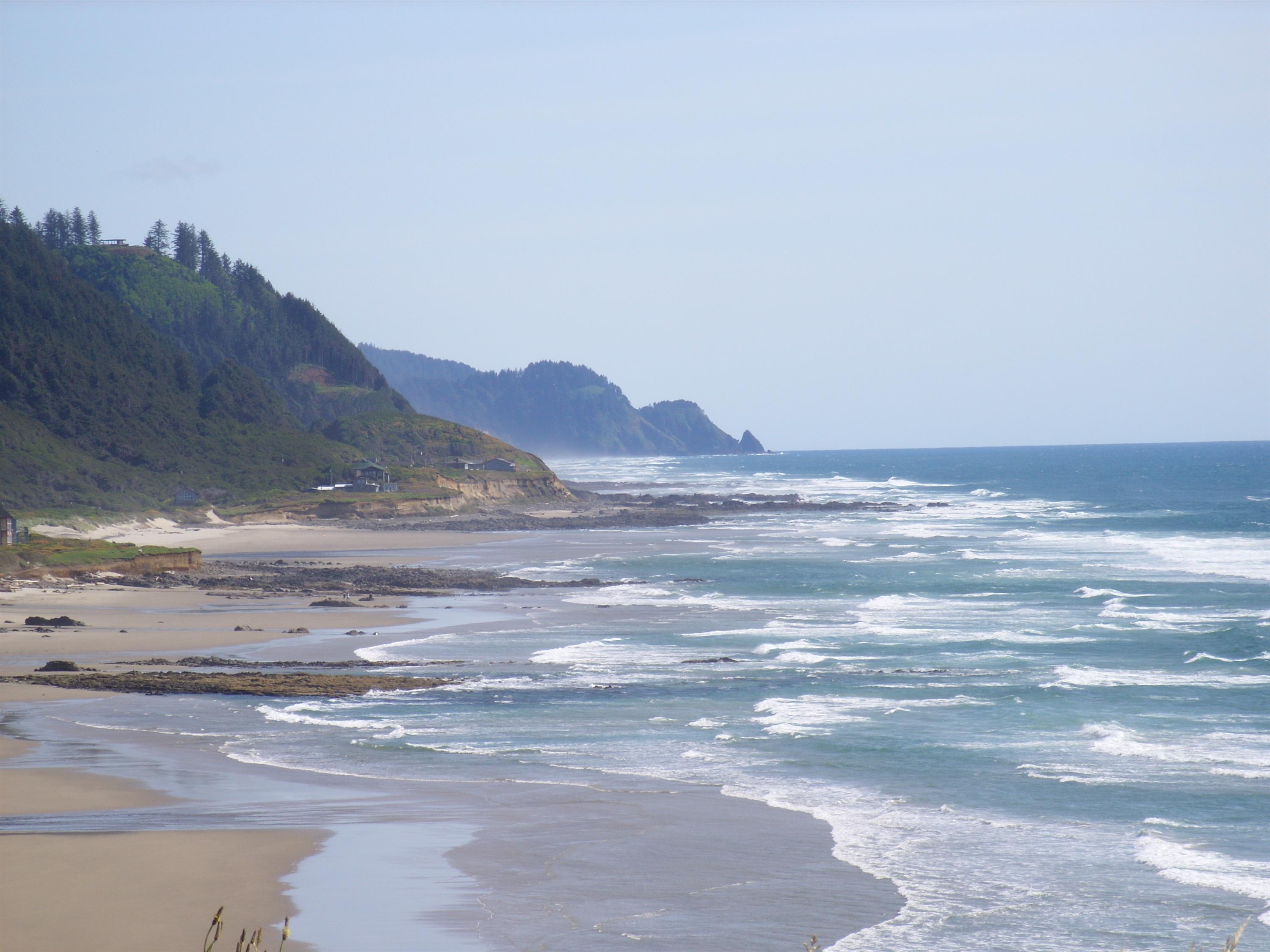
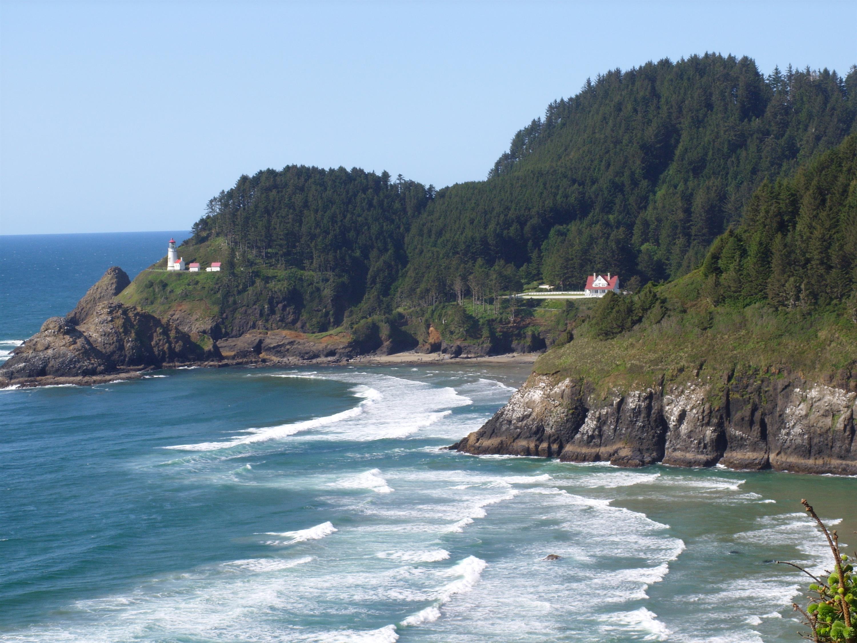
It was a short hike, but it was beautiful. The huge old trees are a treat. After wandering around along the creek for an hour or so, I headed back out. The drive back home was spectacular as well, and I just couldn’t resist taking some pictures as I drove down the coast before heading inland and home:
This picture includes the most photographed lighthouse on the west coast of the US – Heceta Head Lighthouse. If you get a chance to tour it, I suggest doing so. It still has the great fresnel lenses that focus the beam of light as it sweeps the ocean. The sizable building in the mid-right of the photo is the lighthouse keeper’s house, which is now a bed-and-breakfast. That place has loads of history associated with it and a truly spectacular view:
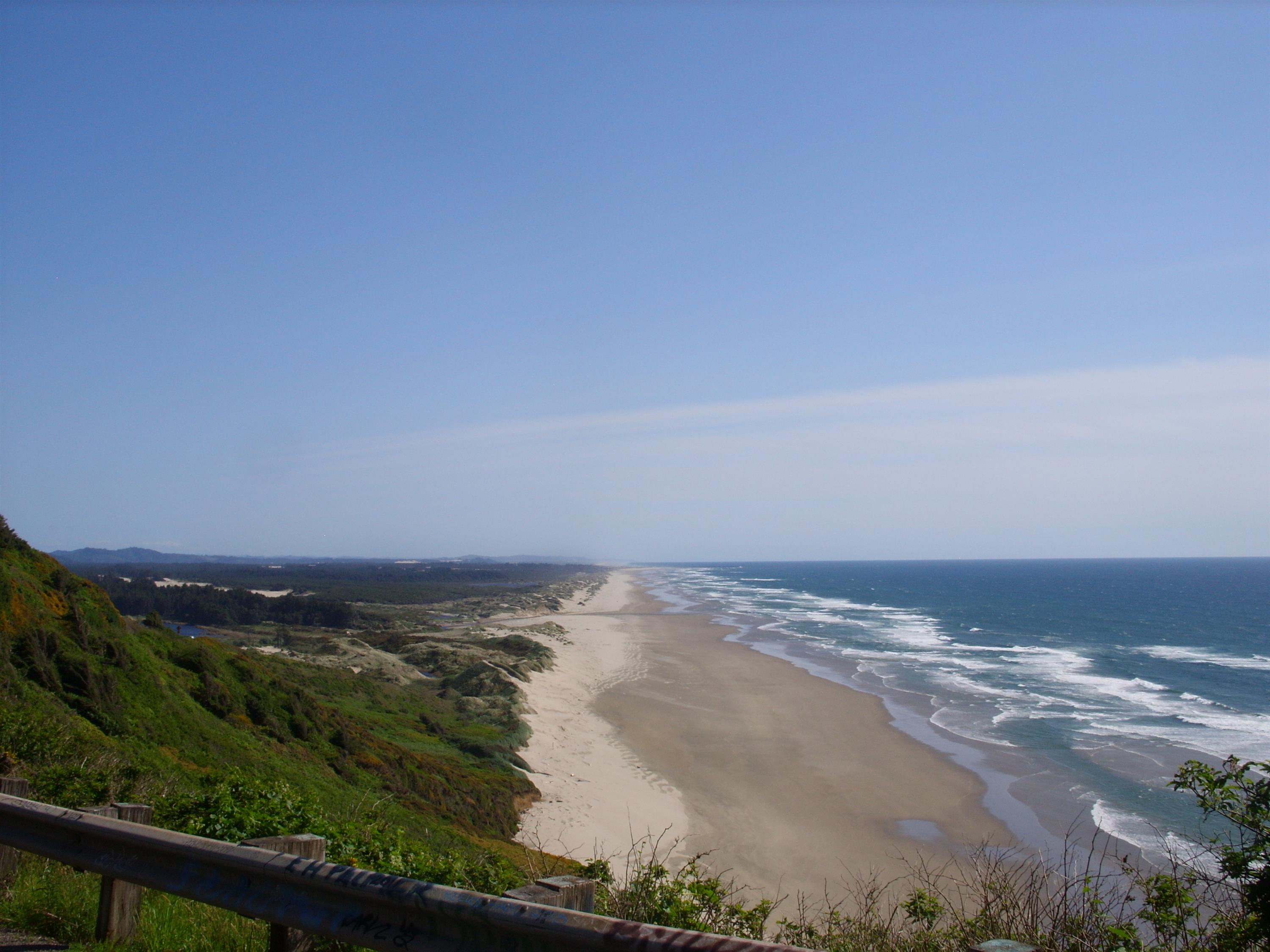
This shot shows the wide beaches that start just north of Florence:
I had a great time. I would have preferred a longer hike, but sections of this one were pretty steep, so I got a decent workout. By the time I finished, my GPS odometer showed I had walked about 7.5 miles. I posted the KMZ file with my track and some waypoints here. Take a look at it in Google Earth. It’ll be fun going back in a few months to camp with a group.
Looks like a great hike. Beautiful pics. Can’t wait to see it all in person this summer.
Ah, those pictures make me so homesick, but thank you for sharing. Beautiful!!
Hi Tim, Gorgeous pictures. The hike sounds wonderful. Faith
Looks freaking gorgeous out there! I wish I could come along to some of your hikes… if it weren’t for school, work and Operation Take Over The World, I would have more time. Maybe this summer :)